MyTopo
Keams Canyon Arizona US Topo Map
Couldn't load pickup availability
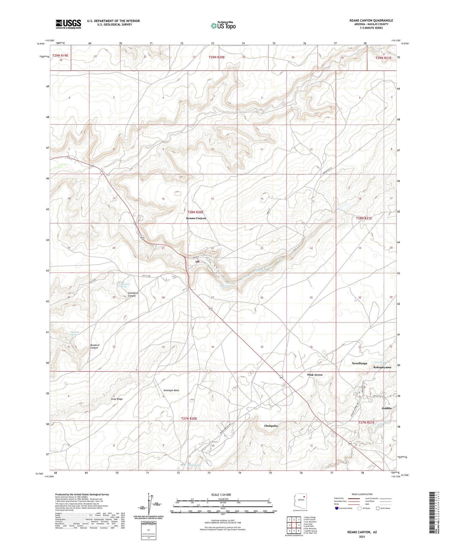
2021 topographic map quadrangle Keams Canyon in the state of Arizona. Scale: 1:24000. Based on the newly updated USGS 7.5' US Topo map series, this map is in the following counties: Navajo. The map contains contour data, water features, and other items you are used to seeing on USGS maps, but also has updated roads and other features. This is the next generation of topographic maps. Printed on high-quality waterproof paper with UV fade-resistant inks.
Quads adjacent to this one:
West: Sun Altar
Northwest: Wepo Village
North: Echo Canyon
Northeast: Low Mountain
East: Lamb Well
Southeast: Tsin Naan Tee
South: Jeddito Spring
Southwest: Star Mountain
This map covers the same area as the classic USGS quad with code o35110g2.
Contains the following named places: Antelope Mesa, Bluebird Spring, Chakpahu, Chili Spring, Department of Health Indian Hospital, Dove Spring, Jeddito, Jeddito Census Designated Place, Jeddito School, Keams Canyon, Keams Canyon Boarding School, Keams Canyon Campground, Keams Canyon Census Designated Place, Keams Canyon Community Park, Keams Canyon Day School, Keams Canyon Fire Department, Keams Canyon Post Office, Kokopnyama, Lake Maho, Nesuftanga, Pink Arrow, Skunk Springs, Snowbird Spring, Twin Dams, ZIP Code: 86034