MyTopo
Keet Seel Canyon Arizona US Topo Map
Couldn't load pickup availability
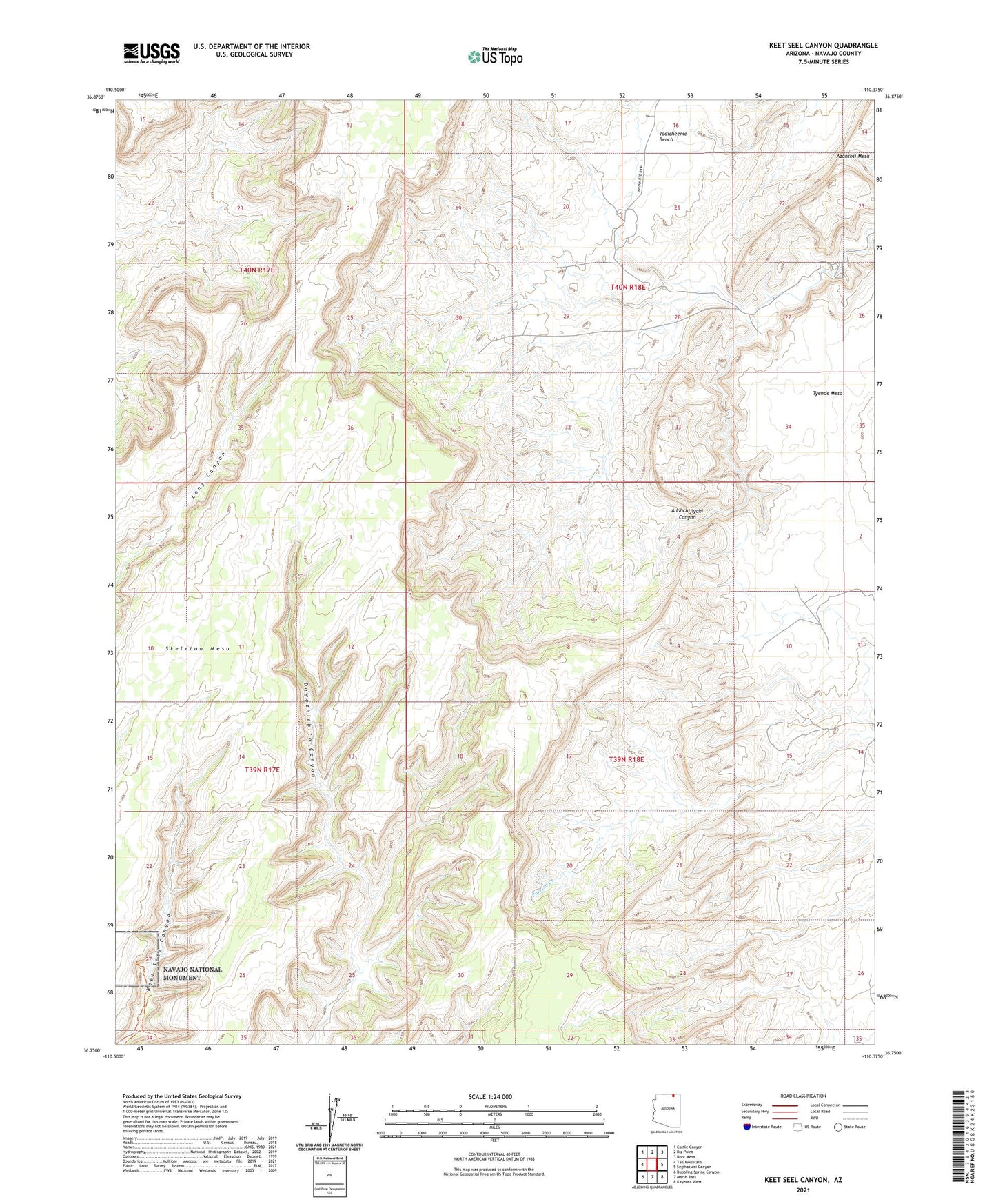
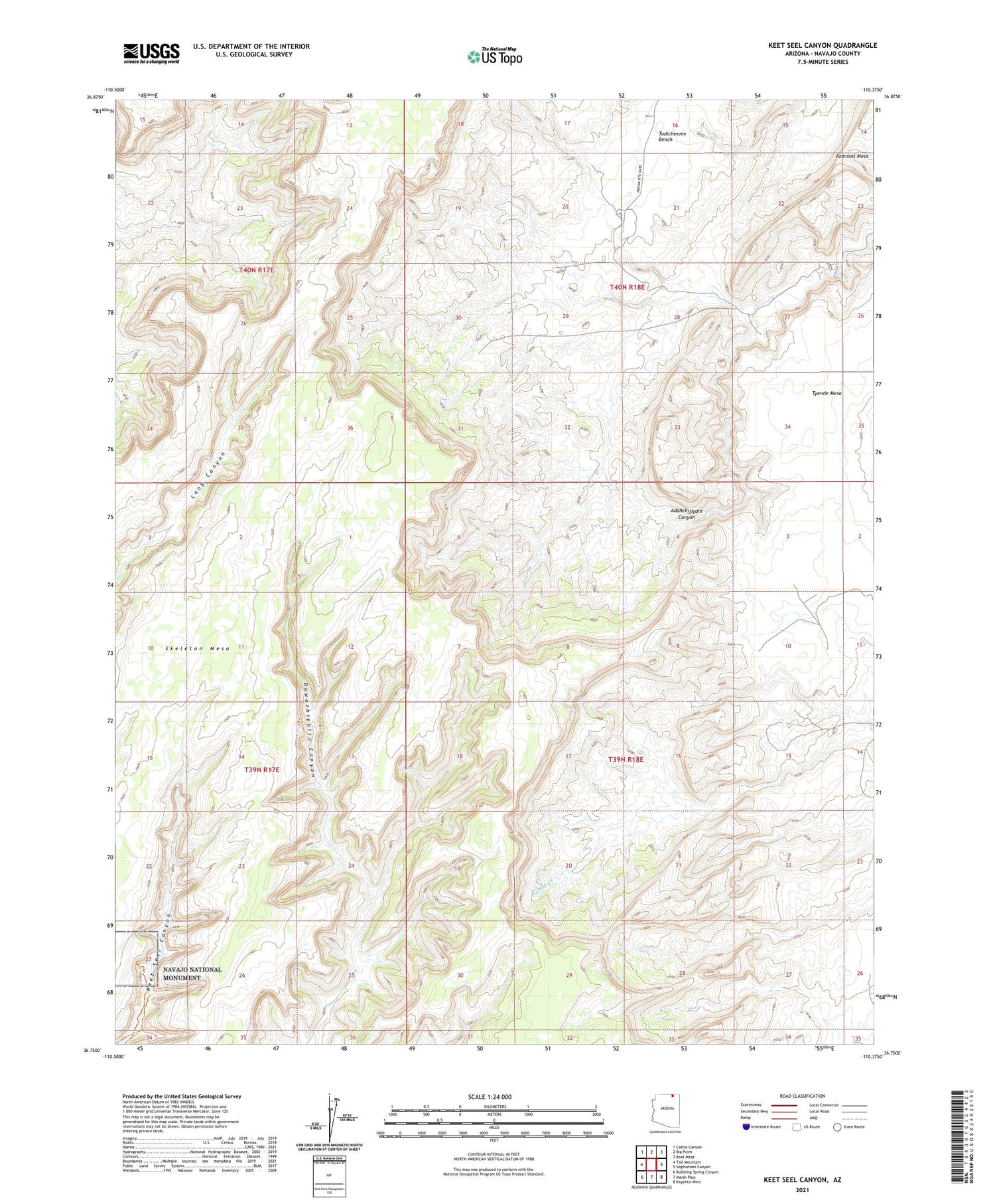
2021 topographic map quadrangle Keet Seel Canyon in the state of Arizona. Scale: 1:24000. Based on the newly updated USGS 7.5' US Topo map series, this map is in the following counties: Navajo. The map contains contour data, water features, and other items you are used to seeing on USGS maps, but also has updated roads and other features. This is the next generation of topographic maps. Printed on high-quality waterproof paper with UV fade-resistant inks.
Quads adjacent to this one:
West: Tall Mountain
Northwest: Cattle Canyon
North: Big Point
Northeast: Boot Mesa
East: Segihatsosi Canyon
Southeast: Kayenta West
South: Marsh Pass
Southwest: Bubbling Spring Canyon
Contains the following named places: Skeleton Mesa