MyTopo
Bubbling Spring Canyon Arizona US Topo Map
Couldn't load pickup availability
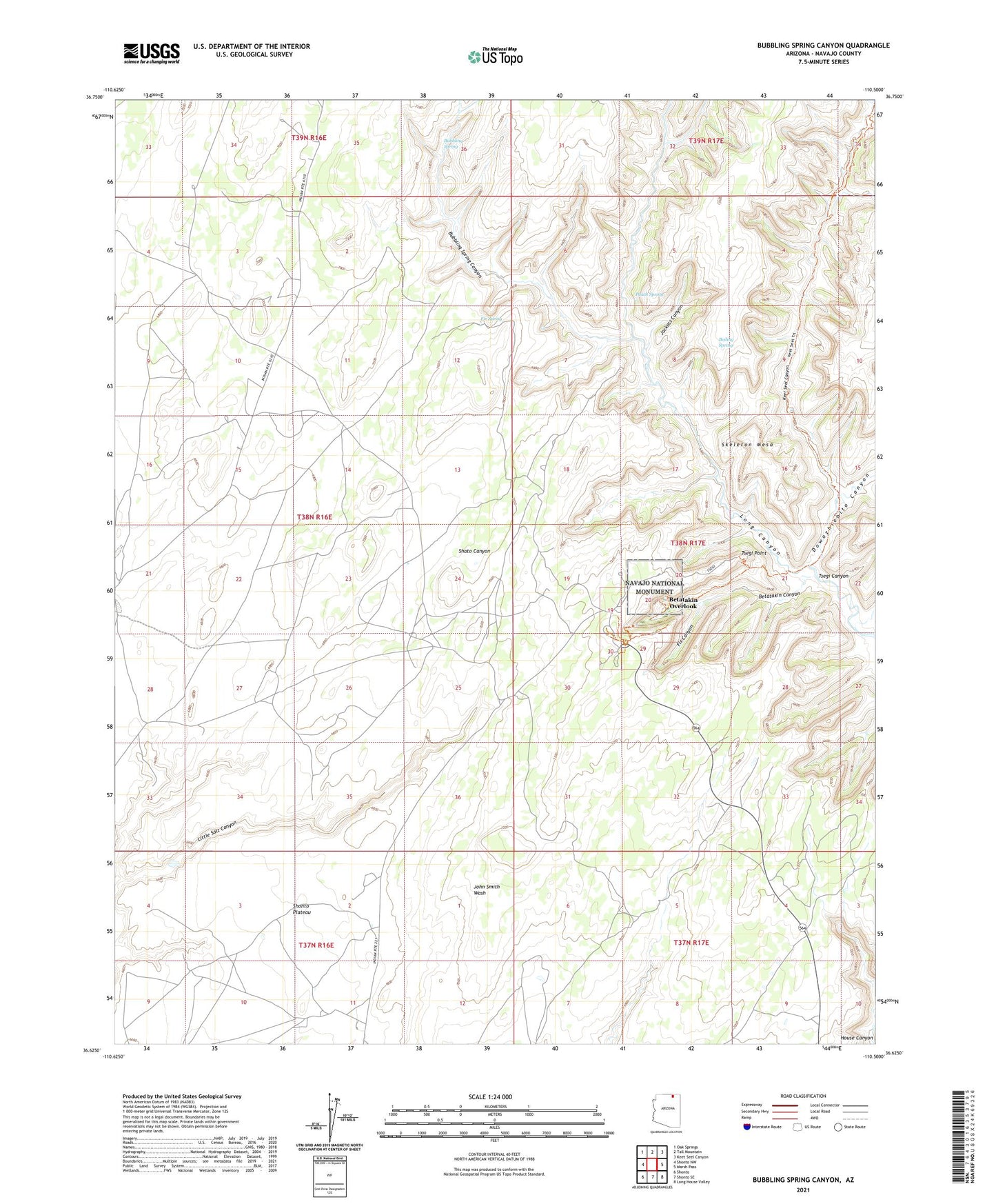
2021 topographic map quadrangle Bubbling Spring Canyon in the state of Arizona. Scale: 1:24000. Based on the newly updated USGS 7.5' US Topo map series, this map is in the following counties: Navajo. The map contains contour data, water features, and other items you are used to seeing on USGS maps, but also has updated roads and other features. This is the next generation of topographic maps. Printed on high-quality waterproof paper with UV fade-resistant inks.
Quads adjacent to this one:
West: Shonto NW
Northwest: Oak Springs
North: Tall Mountain
Northeast: Keet Seel Canyon
East: Marsh Pass
Southeast: Long House Valley
South: Shonto SE
Southwest: Shonto
Contains the following named places: Betatakin Canyon, Betatakin Overlook, Boiling Spring, Bubbling Spring, Bubbling Spring Canyon, Dowozhiebito Canyon, Fir Canyon, Fir Spring, Jackass Canyon, Keet Seel Canyon, Little Salt Canyon, Long Canyon, Navajo National Monument, Navajo National Monument Campground, Navajo National Monument Headquarters, Peach Spring, Shonto Chapter, Tsegi Point, Tsegi Point Overlook, ZIP Code: 86054