MyTopo
Kingman Airport Arizona US Topo Map
Couldn't load pickup availability
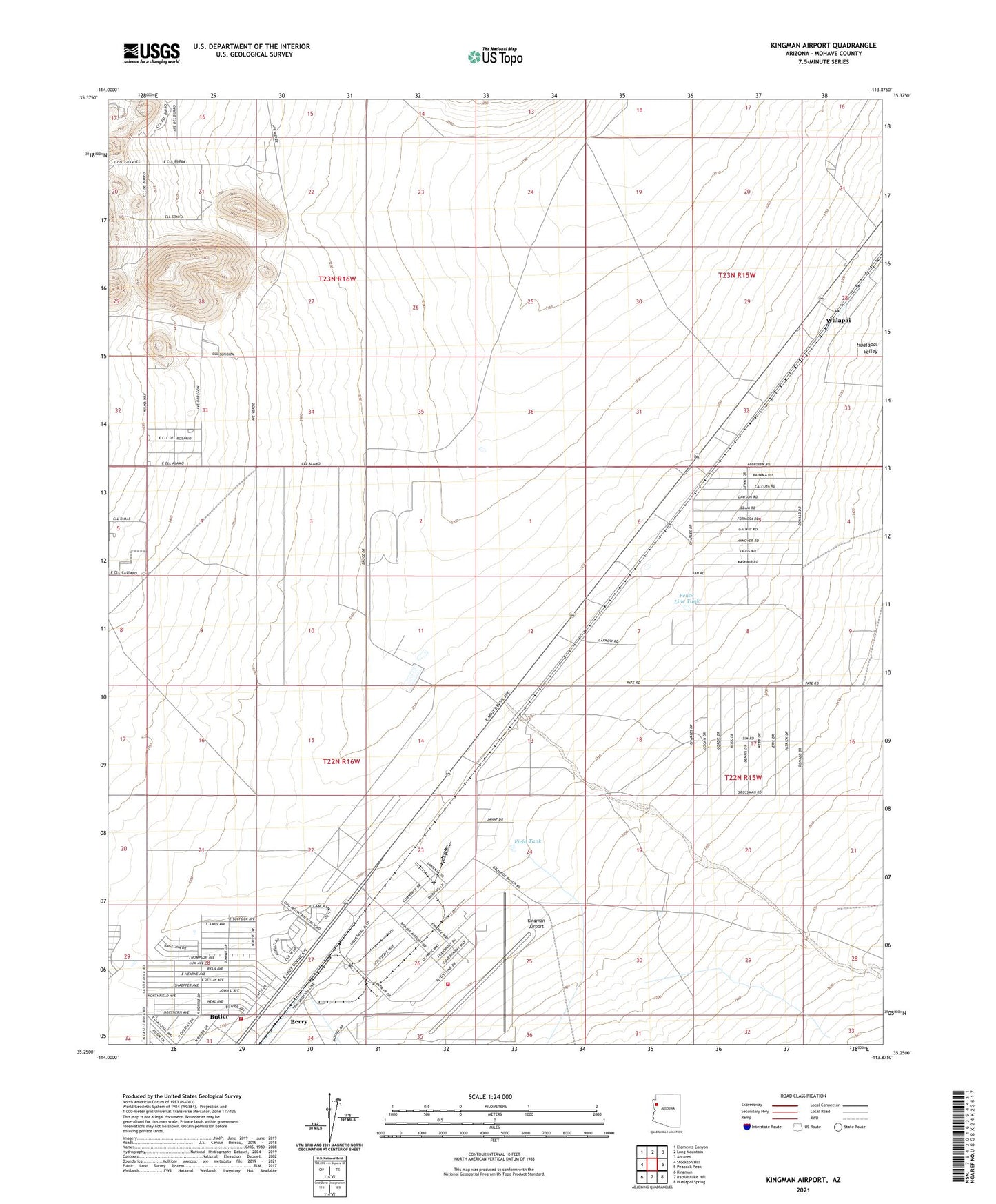
2021 topographic map quadrangle Kingman Airport in the state of Arizona. Scale: 1:24000. Based on the newly updated USGS 7.5' US Topo map series, this map is in the following counties: Mohave. The map contains contour data, water features, and other items you are used to seeing on USGS maps, but also has updated roads and other features. This is the next generation of topographic maps. Printed on high-quality waterproof paper with UV fade-resistant inks.
Quads adjacent to this one:
West: Stockton Hill
Northwest: Elements Canyon
North: Long Mountain
Northeast: Antares
East: Peacock Peak
Southeast: Hualapai Spring
South: Rattlesnake Hill
Southwest: Kingman
This map covers the same area as the classic USGS quad with code o35113c8.
Contains the following named places: Berry, Butler, Calvary Baptist Church, Fence Line Tank, Field Tank, Frees Wash, Kingman Airport, Kingman Army Air Field, Long Mountain Ranch, Northern Arizona Consolidated Fire District Station 32, Northern Arizona Consolidated Fire District Station 34, Walapai, Walapai Railroad Station