
MyTopo
Kinlichee Arizona US Topo Map
Couldn't load pickup availability
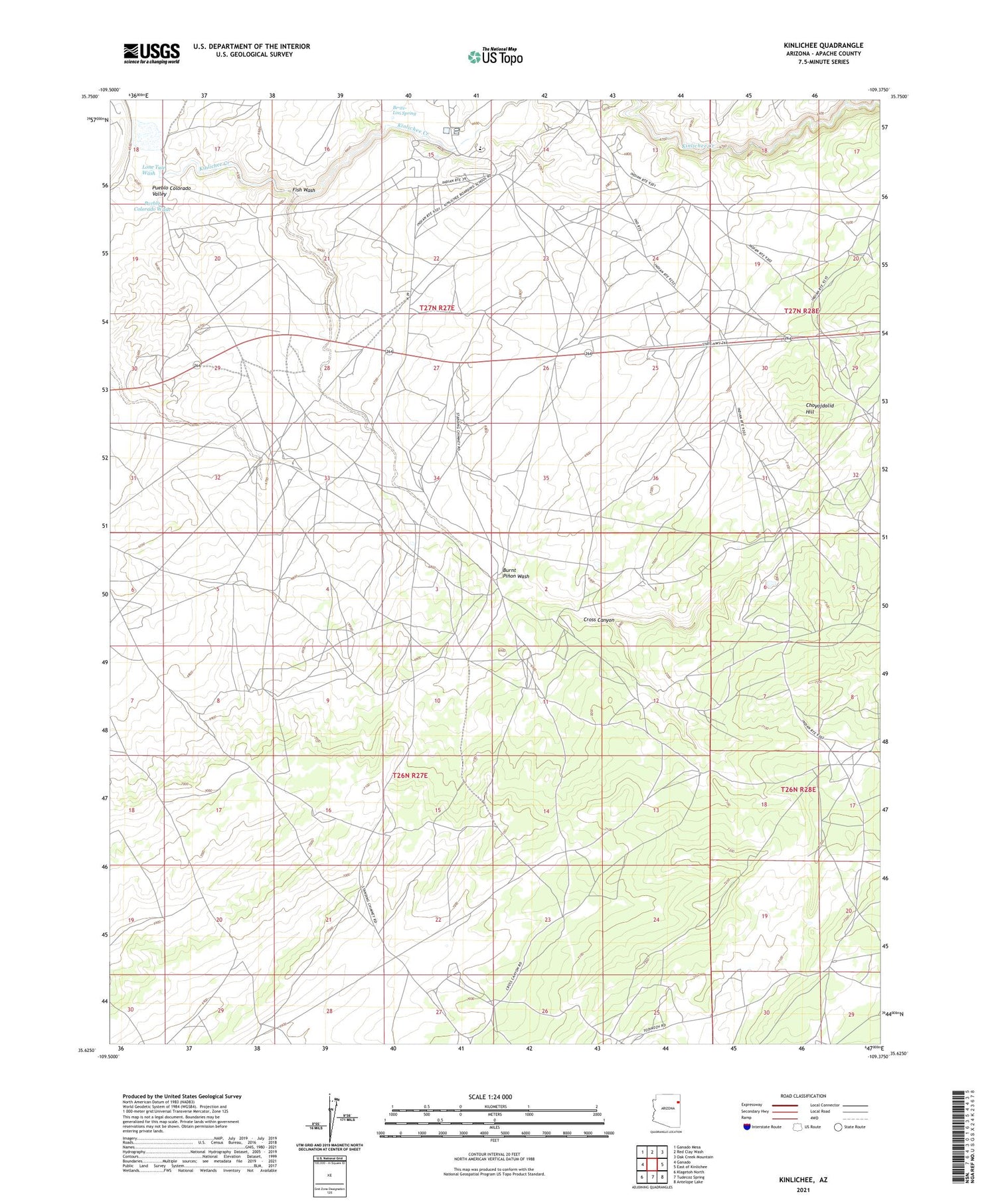
2021 topographic map quadrangle Kinlichee in the state of Arizona. Scale: 1:24000. Based on the newly updated USGS 7.5' US Topo map series, this map is in the following counties: Apache. The map contains contour data, water features, and other items you are used to seeing on USGS maps, but also has updated roads and other features. This is the next generation of topographic maps. Printed on high-quality waterproof paper with UV fade-resistant inks.
Quads adjacent to this one:
West: Ganado
Northwest: Ganado Mesa
North: Red Clay Wash
Northeast: Oak Creek Mountain
East: East of Kinlichee
Southeast: Antelope Lake
South: Tudecoz Spring
Southwest: Klagetoh North
This map covers the same area as the classic USGS quad with code o35109f4.
Contains the following named places: Be-ite-Lini Spring, Burnt Pinon Wash, Choyojdolid Hill, Cross Canyon, Cross Canyon Recreation Area, Cross Canyon Trading Post, Fish Wash, Kin Dah Lichi'i Olta' Charter School, Kinlichee Chapter House, Kinlichee Creek, Lone Tule Wash, Ruin Wash


