
MyTopo
Lukeville Arizona US Topo Map
Couldn't load pickup availability
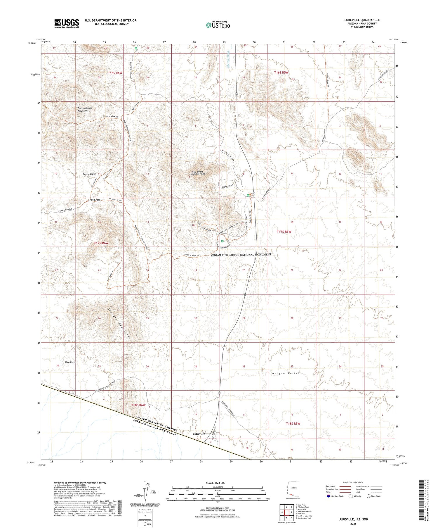
2021 topographic map quadrangle Lukeville in the state of Arizona. Scale: 1:24000. Based on the newly updated USGS 7.5' US Topo map series, this map is in the following counties: Pima. The map contains contour data, water features, and other items you are used to seeing on USGS maps, but also has updated roads and other features. This is the next generation of topographic maps. Printed on high-quality waterproof paper with UV fade-resistant inks.
Quads adjacent to this one:
West: West of Lukeville
Northwest: Kino Peak
North: Tillotson Peak
Northeast: Mount Ajo
East: Diaz Peak
Southeast: Blankenship Well
South: South of Lukeville
This map covers the same area as the classic USGS quad with code o31112h7.
Contains the following named places: Baker Mine, Dowling Ranch, Gadsden Peak, Levy Peak, Lost Cabin Mine, Lukeville, Marine Mine, Martinez Mine, Organ Pipe Cactus Family Picnic Ground, Organ Pipe Cactus National Monument Visitors Center, Organ Pipe Family Campground, Port of Entry Lukeville, Red Tanks Well, Senita Basin, Senita Pass, Sonoyta Mountains, Twin Peaks, Victoria Mine, ZIP Code: 85341


