
MyTopo
Mount Ajo Arizona US Topo Map
Couldn't load pickup availability
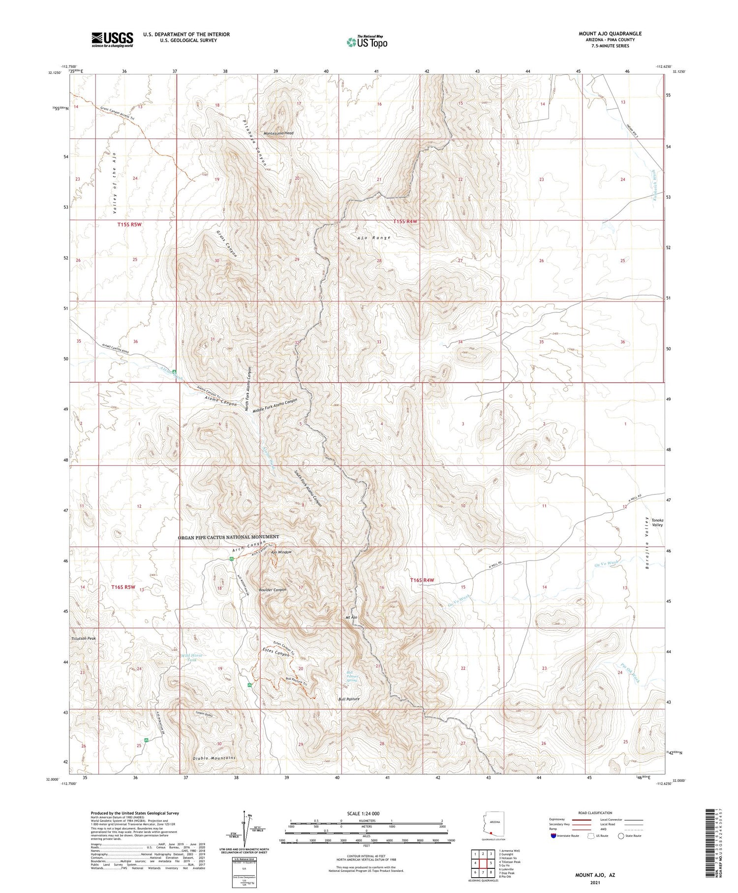
2021 topographic map quadrangle Mount Ajo in the state of Arizona. Scale: 1:24000. Based on the newly updated USGS 7.5' US Topo map series, this map is in the following counties: Pima. The map contains contour data, water features, and other items you are used to seeing on USGS maps, but also has updated roads and other features. This is the next generation of topographic maps. Printed on high-quality waterproof paper with UV fade-resistant inks.
Quads adjacent to this one:
West: Tillotson Peak
Northwest: Armenta Well
North: Gunsight
Northeast: Hotason Vo
East: Gu Vo
Southeast: Pia Oik
South: Diaz Peak
Southwest: Lukeville
This map covers the same area as the classic USGS quad with code o32112a6.
Contains the following named places: Ajo Window, Alamo Canyon, Arch Canyon, Barajita Well, Boulder Canyon, Bull Pasture, Bull Pasture Spring, Canyon Diablo, Diablo Mountains, Diablo Tank, Estes Canyon, Grass Canyon, Middle Fork Alamo Canyon, Montezuma Head, Mount Ajo, North Fork Alamo Canyon, Pitahaya Canyon, South Fork Alamo Canyon, Tonoka Well, Wild Horse Tank


