
MyTopo
Many Farms Arizona US Topo Map
Couldn't load pickup availability
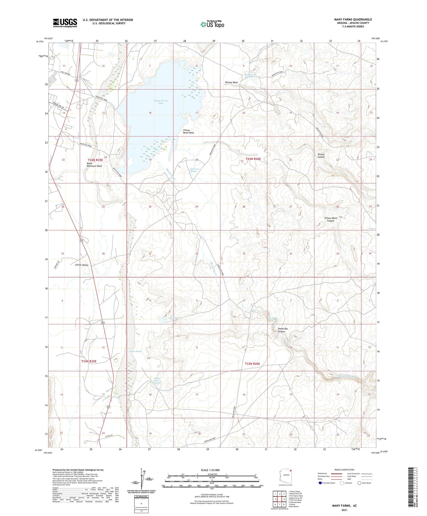
2021 topographic map quadrangle Many Farms in the state of Arizona. Scale: 1:24000. Based on the newly updated USGS 7.5' US Topo map series, this map is in the following counties: Apache. The map contains contour data, water features, and other items you are used to seeing on USGS maps, but also has updated roads and other features. This is the next generation of topographic maps. Printed on high-quality waterproof paper with UV fade-resistant inks.
Quads adjacent to this one:
West: Many Farms SW
Northwest: Windy Valley
North: Many Farms NE
Northeast: Fire Dance Mesa
East: Tall Tree Mesa
Southeast: Del Muerto
South: Chinle
Southwest: Ventana Mesa
This map covers the same area as the classic USGS quad with code o36109c5.
Contains the following named places: Black Mountain Wash, Chinle Valley Store, Hard Spring, Jimson Weed Canyon, Jimson Weed Wash, Many Farms, Many Farms Chapter, Many Farms Child Development Center, Many Farms Dam, Many Farms Lake, Many Farms Lake Campground, Many Farms Public School, Many Farms Spring, Many Farms Trading Post, Sand Cone Springs, Sheep Dip Canyon, Sheep Dip Creek, Tezinie Canyon, Tezinie Wash, Valley Store Spring


