MyTopo
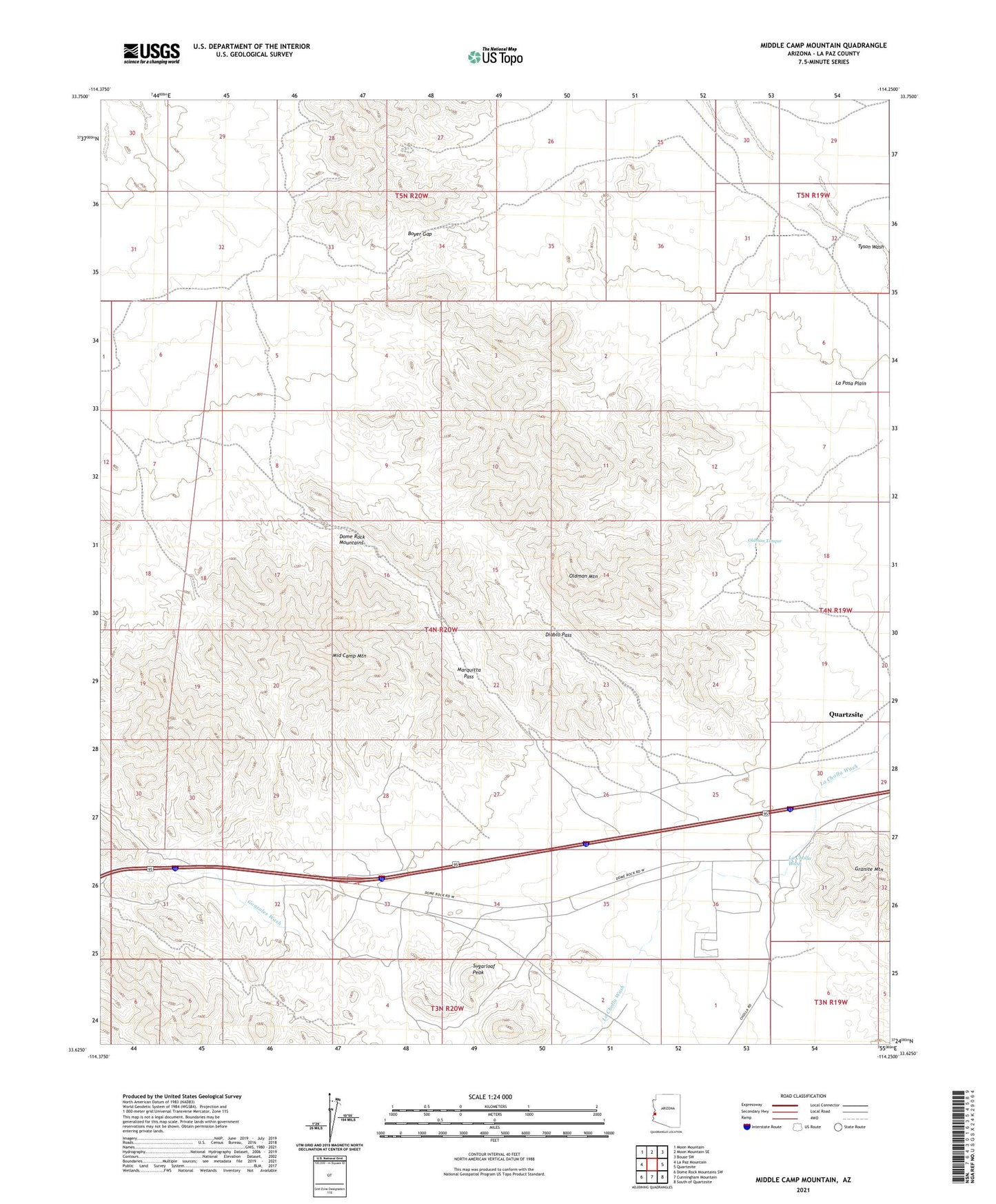
Middle Camp Mountain Arizona US Topo Map
Couldn't load pickup availability
2021 topographic map quadrangle Middle Camp Mountain in the state of Arizona. Scale: 1:24000. Based on the newly updated USGS 7.5' US Topo map series, this map is in the following counties: La Paz. The map contains contour data, water features, and other items you are used to seeing on USGS maps, but also has updated roads and other features. This is the next generation of topographic maps. Printed on high-quality waterproof paper with UV fade-resistant inks.
Quads adjacent to this one:
West: La Paz Mountain
Northwest: Moon Mountain
North: Moon Mountain SE
Northeast: Bouse SW
East: Quartzsite
Southeast: South of Quartzsite
South: Cunningham Mountain
Southwest: Dome Rock Mountains SW
This map covers the same area as the classic USGS quad with code o33114f3.
Contains the following named places: Bear Mine, Boyer Gap, Colrio Mine, Darling Mine, Diablo Pass, Dome Basin Mine, Dome Rock Mountains, Gonzales Well, Granite Mountain, Julian Mine, Lead Well, Marquitta Mine, Marquitta Pass, Middle Camp Mountain, Oldman Mountain, Oldman Tanque, Sugarloaf Peak