MyTopo
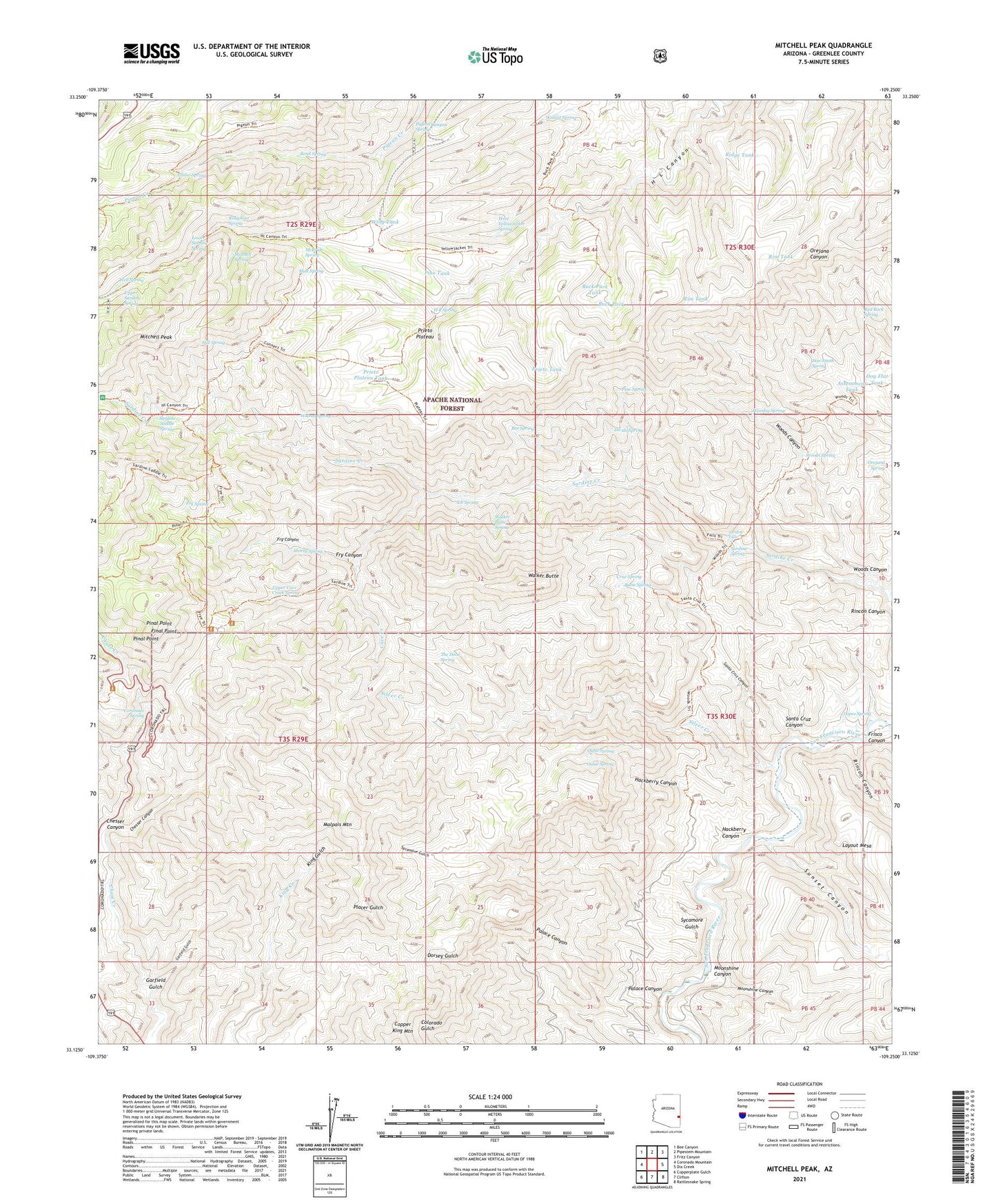
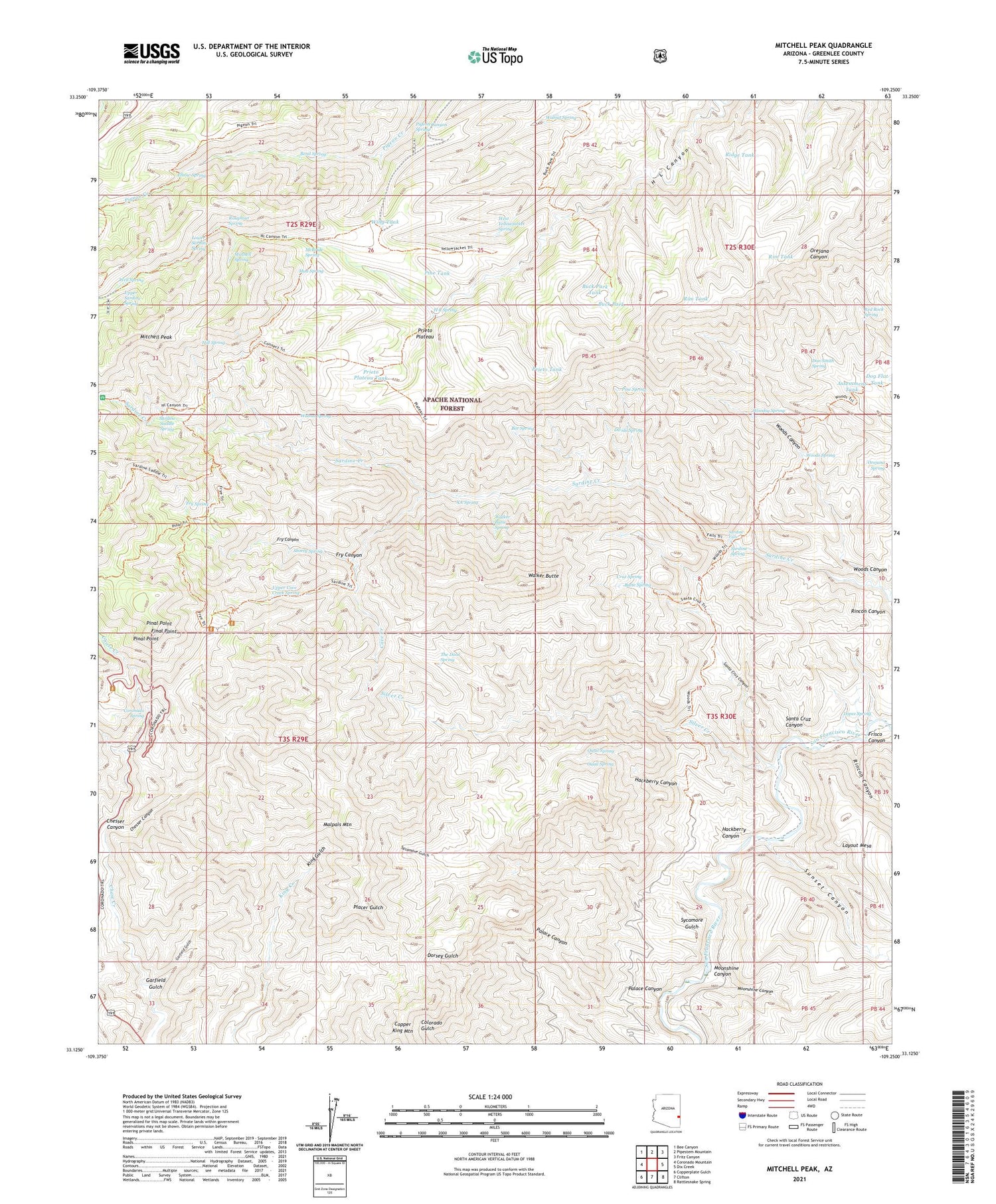
Mitchell Peak Arizona US Topo Map
Couldn't load pickup availability
Also explore the Mitchell Peak Forest Service Topo of this same quad for updated USFS data
2021 topographic map quadrangle Mitchell Peak in the state of Arizona. Scale: 1:24000. Based on the newly updated USGS 7.5' US Topo map series, this map is in the following counties: Greenlee. The map contains contour data, water features, and other items you are used to seeing on USGS maps, but also has updated roads and other features. This is the next generation of topographic maps. Printed on high-quality waterproof paper with UV fade-resistant inks.
Quads adjacent to this one:
West: Coronado Mountain
Northwest: Bee Canyon
North: Pipestem Mountain
Northeast: Fritz Canyon
East: Dix Creek
Southeast: Rattlesnake Spring
South: Clifton
Southwest: Copperplate Gulch
This map covers the same area as the classic USGS quad with code o33109b3.
Contains the following named places: Assessment Tank, Bee Spring, Bend Spring, Buck Park, Buck Park Tank, Butte Spring, Cave Creek, Cave Creek Corral, Cement Tank, Cement Tank Corral, Chesser Canyon, Coronado Spring, Cruz Spring, Dam Tank, Divide Spring, Dog Flat Corral, Dog Flat Tank, Don Smith Spring, Elbow Spring, Final Point, Fry Canyon, Fry Spring, Frye Trail Twelve, Garfield Gulch, H L Canyon Eleven Trail, H L Spring, Hackberry Canyon, Hill Spring, Lopez Corral, Lopez Spring, Lower Cave Creek Spring, Lower Sardine Spring, Malpais Corral, Malpais Mountain, McBride Spring, Mitchell Peak, Mitchell Spring, Moonshine Canyon, Mud Spring, Orejana Spring, Ouail Spring, Palace Canyon, Pigeon Canyon Spring, Pinal Point, Pine Spring, Pine Tank, Prieto Plateau, Prieto Plateau Tank, Prieto Tank, Quail Spring, Red Rock Spring, Ridge Tank, Rim Tank, Rincon Canyon, Roughout Spring, Saddle Corral, Santa Cruz Canyon, Santa Cruz Corral, Sardine Falls, Sardine Saddle Picnic Area, Sardine Saddle Spring, Sardine Spring, Shorty Spring, Silver Creek, Stevens Mine, Stevens Tank, Sunset Canyon, Sycamore Gulch, The Door Spring, Upper Cove Creek Spring, Upper Sardine Spring, Walker Butte, Walker Butte Spring, Walnut Spring, Well Spring, West Yellowjacket Spring, Wing Tank, Wood Spring Corral, Woods Canyon, Woods Spring, Woodsy Spring, XA Spring