
MyTopo
Rattlesnake Spring Arizona US Topo Map
Couldn't load pickup availability
Also explore the Rattlesnake Spring Forest Service Topo of this same quad for updated USFS data
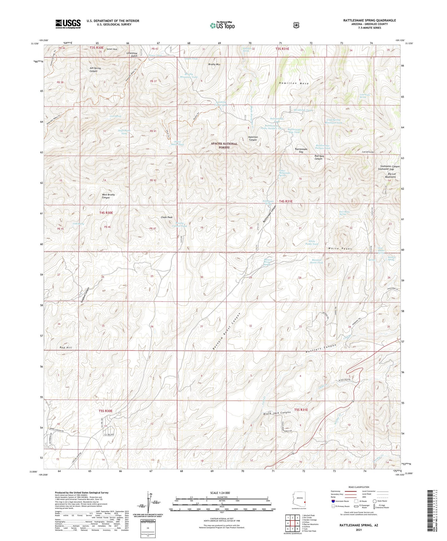
2021 topographic map quadrangle Rattlesnake Spring in the state of Arizona. Scale: 1:24000. Based on the newly updated USGS 7.5' US Topo map series, this map is in the following counties: Greenlee. The map contains contour data, water features, and other items you are used to seeing on USGS maps, but also has updated roads and other features. This is the next generation of topographic maps. Printed on high-quality waterproof paper with UV fade-resistant inks.
Quads adjacent to this one:
West: Clifton
Northwest: Mitchell Peak
North: Dix Creek
Northeast: Harden Cienega
East: Big Lue Mountains
Southeast: Tillie Hall Peak
South: York
Southwest: Guthrie
This map covers the same area as the classic USGS quad with code o33109a2.
Contains the following named places: Black Jack Canyon, Brushy Canyon Tank, Brushy Mountain, Brushy Mountain Tank, BUckhorn Tank, Buzzard Roost Spring, Buzzard Roost Tank, Cave Spring, Chalk Peak, Cold Spring Mountain, Cold Spring Mountain Tank, Cold Water Spring, Corner Tank, Deer Basin Spring, Fence Tank, Frank Davis Ranch, Gap Holding Corral, Gayle Tank, Gold Spring, Hamilton Mesa, Hamilton Spring, Lambing Camp Tank, Lyda Creek, Phillips Ranch, Rattlesnake Gap, Rattlesnake Gap Camp, Rattlesnake Gap Tank, Rattlesnake Pasture Tank, Rattlesnake Spring, Rattlesnake Tank, Rattlesnake Tanks Number Two, Red Hill, Rustlers Canyon, Rustlers Spring, Silver Basin Corral, Silver Basin Tank, Sixshooter Gap, Soapbox Canyon, Sunset Peak, Upper Rattlesnake Spring, West Brushy Canyon Tank, West Rustler Spring, West Rustlers Spring, White Peaks, White Peaks Tank, Woods Canyon Tank


