MyTopo
Mule Wash Arizona US Topo Map
Couldn't load pickup availability
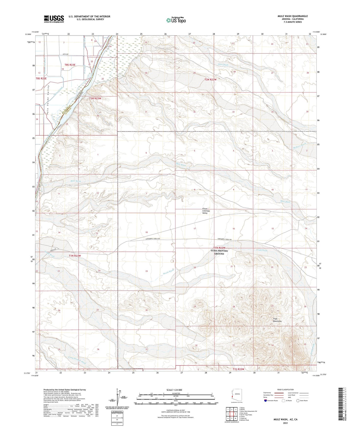
2021 topographic map quadrangle Mule Wash in the states of Arizona, California. Scale: 1:24000. Based on the newly updated USGS 7.5' US Topo map series, this map is in the following counties: La Paz, Riverside. The map contains contour data, water features, and other items you are used to seeing on USGS maps, but also has updated roads and other features. This is the next generation of topographic maps. Printed on high-quality waterproof paper with UV fade-resistant inks.
Quads adjacent to this one:
West: Palo Verde
Northwest: Ripley
North: Blythe
Northeast: Dome Rock Mountains SW
East: North Trigo Peaks
Southeast: Mohave Peak
South: Cibola SE
Southwest: Cibola
Contains the following named places: Borrow Pit Drain, D 23 Spill, D-23 Canal, Mohave Wash, Mule Wash