MyTopo
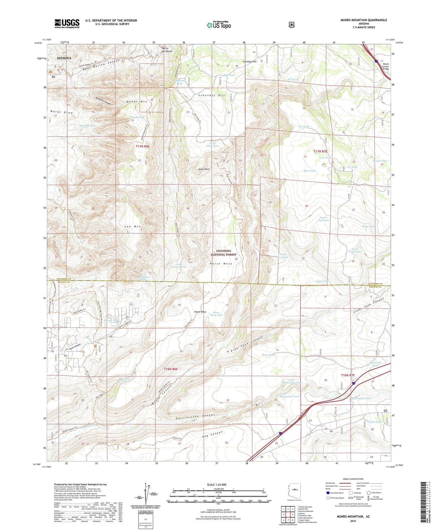
Munds Mountain Arizona US Topo Map
Couldn't load pickup availability
Also explore the Munds Mountain Forest Service Topo of this same quad for updated USFS data
2021 topographic map quadrangle Munds Mountain in the state of Arizona. Scale: 1:24000. Based on the newly updated USGS 7.5' US Topo map series, this map is in the following counties: Coconino, Yavapai. The map contains contour data, water features, and other items you are used to seeing on USGS maps, but also has updated roads and other features. This is the next generation of topographic maps. Printed on high-quality waterproof paper with UV fade-resistant inks.
Quads adjacent to this one:
West: Sedona
Northwest: Wilson Mountain
North: Munds Park
Northeast: Mormon Mountain
East: Stoneman Lake
Southeast: Apache Maid Mountain
South: Casner Butte
Southwest: Lake Montezuma
This map covers the same area as the classic USGS quad with code o34111g6.
Contains the following named places: Basin Tank, Bear Tank, Beaver Tank, Cat Tank, Cedar Tank, Cedar Tank Canyon, Committee Tank, Cons Tank, County Line Tank, Coyote Pup Tank, Cub Tank, Damfino Canyon, Dutchs Tank, H A Tank, Horse Mesa, Horse Mesa Tank, Horse Tank, Horse Trap Tank, Hot Loop Tank, Hot Loop Trail, Jack Canyon-Munds Mountain Fifty Five - Seventy Seven, Jacks Canyon Tank, Jacks Point, Jacks Point Tank, Lee Mountain, Lee Mountain Spring, Lower Rattlesnake Tank, Munds Mountain, Munds Mountain Wilderness, Munds Tank, Natural Tank, Oak Tank, Pine Tank Canyon, Rattlesnake Canyon, Rattlesnake Tank, Ridge Tank, Robbers Roost, Sheeptrail Tank, Skeleton Tank, Speeds Tank, Upper Rattlesnake Tank, Woods Canyon, Woods Canyon Bridge, Woods Ranch