MyTopo
Mystery Valley Arizona US Topo Map
Couldn't load pickup availability
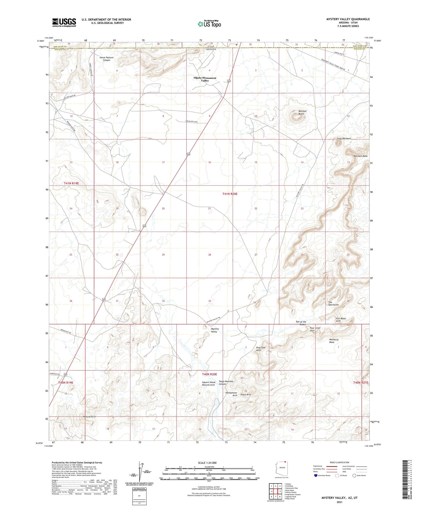
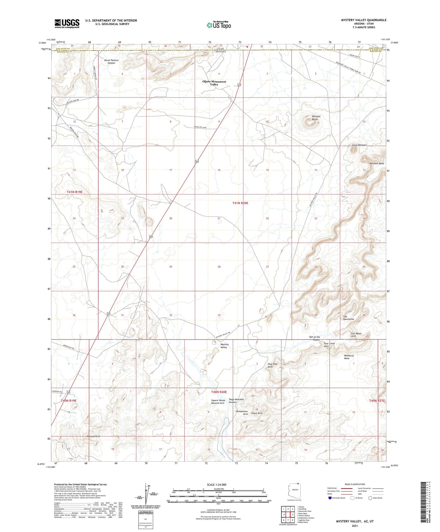
2021 topographic map quadrangle Mystery Valley in the states of Arizona, Utah. Scale: 1:24000. Based on the newly updated USGS 7.5' US Topo map series, this map is in the following counties: Navajo, San Juan. The map contains contour data, water features, and other items you are used to seeing on USGS maps, but also has updated roads and other features. This is the next generation of topographic maps. Printed on high-quality waterproof paper with UV fade-resistant inks.
Quads adjacent to this one:
West: Boot Mesa
Northwest: Oljato
North: Goulding
Northeast: Monument Pass
East: Mitten Buttes
Southeast: Baby Rocks
South: Agathla Peak
Southwest: Segihatsosi Canyon
Contains the following named places: Eye of the Rabbit, Four Level Arch, Full Moon Arch, Goulding Well, Gray Whiskers, Honeymoon Arch, Horse Pasture Canyon, Mitchell Butte, Monument Number 1 Tunnel, Monument Number One Annex, Mystery Valley, Natural Arch, Oljato-Monument Valley Census Designated Place, Pine Tree Arch, San Juan Fire Department Monument Valley Station, Square House Natural Arch, Stout Arch, The Spectacles, Tseya Neechee Canyon, Utah Navajo Health System Ambulance - Oljato - Monument Valley, Wetherill Mesa