MyTopo
Goulding Utah US Topo Map
Couldn't load pickup availability
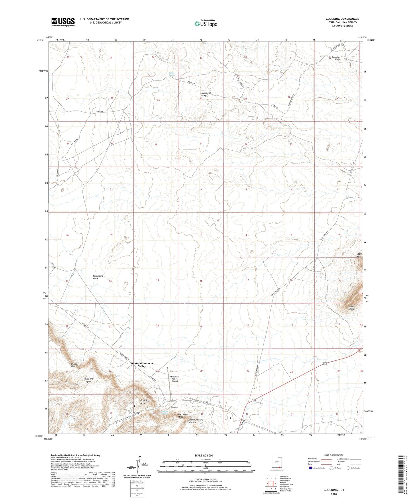
2023 topographic map quadrangle Goulding in the state of Utah. Scale: 1:24000. Based on the newly updated USGS 7.5' US Topo map series, this map is in the following counties: San Juan. The map contains contour data, water features, and other items you are used to seeing on USGS maps, but also has updated roads and other features. This is the next generation of topographic maps. Printed on high-quality waterproof paper with UV fade-resistant inks.
Quads adjacent to this one:
West: Oljato
Northwest: Oljato NE
North: Goulding NW
Northeast: Goulding NE
East: Monument Pass
Southeast: Mitten Buttes
South: Mystery Valley
Southwest: Boot Mesa
This map covers the same area as the classic USGS quad with code o37110a2.
Contains the following named places: Cedar Spring, Eagle Rock, Goulding, Goulding Arch, Goulding Trading Post, Monument Valley Adventist Hospital, Monument Valley Airport, Monument Valley High School, Monument Valley Hospital Heliport, Monument Valley State Park, Monument Wash, Nepalto Spring, Oljato Chapter, Rock Door Mesa, Skyline Mine, The Gap