MyTopo
Navajo Bridge Arizona US Topo Map
Couldn't load pickup availability
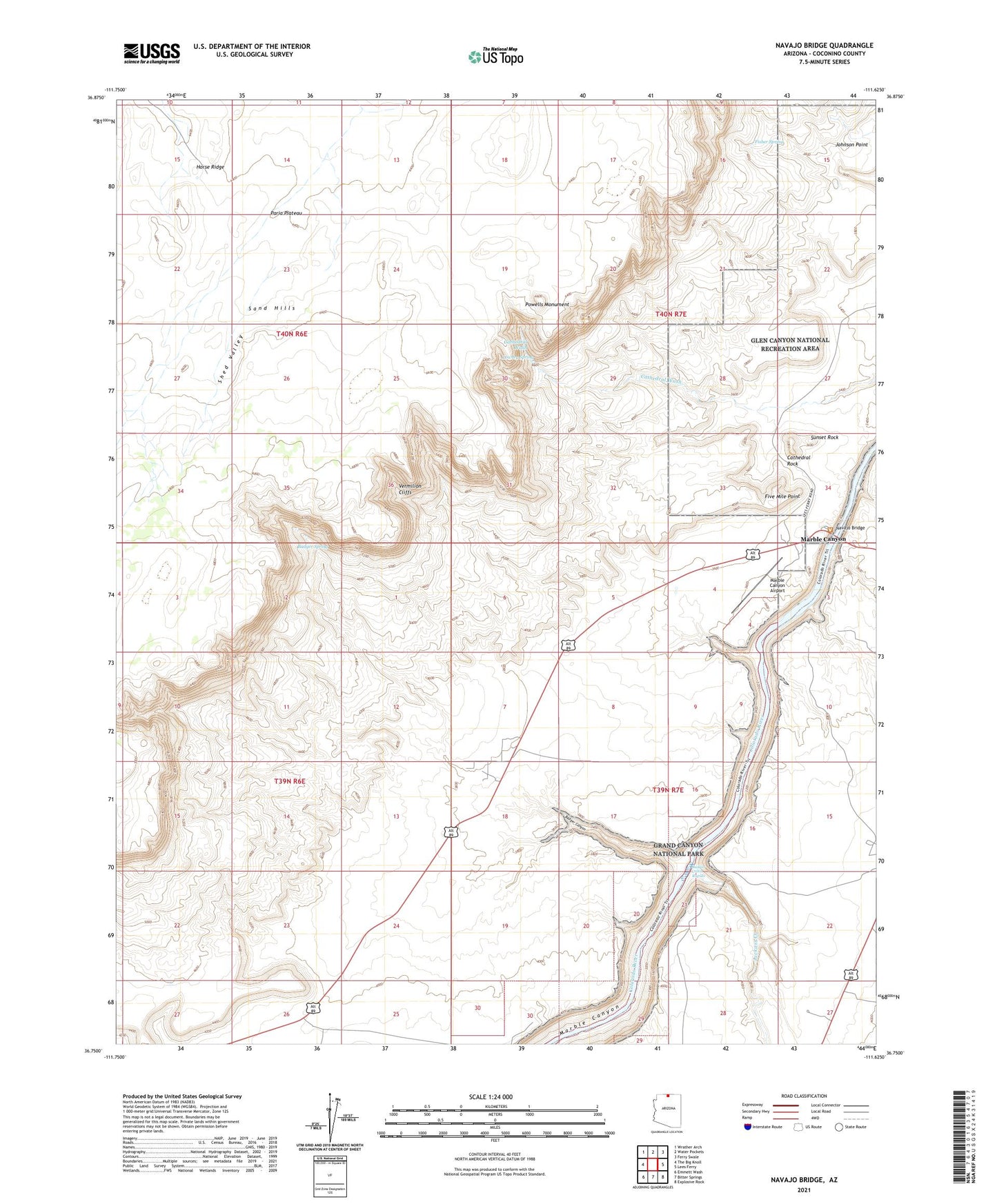
2021 topographic map quadrangle Navajo Bridge in the state of Arizona. Scale: 1:24000. Based on the newly updated USGS 7.5' US Topo map series, this map is in the following counties: Coconino. The map contains contour data, water features, and other items you are used to seeing on USGS maps, but also has updated roads and other features. This is the next generation of topographic maps. Printed on high-quality waterproof paper with UV fade-resistant inks.
Quads adjacent to this one:
West: The Big Knoll
Northwest: Wrather Arch
North: Water Pockets
Northeast: Ferry Swale
East: Lees Ferry
Southeast: Explosive Rock
South: Bitter Springs
Southwest: Emmett Wash
This map covers the same area as the classic USGS quad with code o36111g6.
Contains the following named places: Badger Canyon, Badger Creek Rapids, Badger Spring, Cathedral Rock, Fisher Spring, Five Mile Point, Jackass Creek, Lowrey Spring, Marble Canyon, Marble Canyon Airport, Marble Canyon Lodge, Navajo Bridge, Powells Monument, Shed Valley, Shed Valley Tank, Sunset Rock, Vermilion Cliffs Lodge