MyTopo
Navajo Springs Arizona US Topo Map
Couldn't load pickup availability
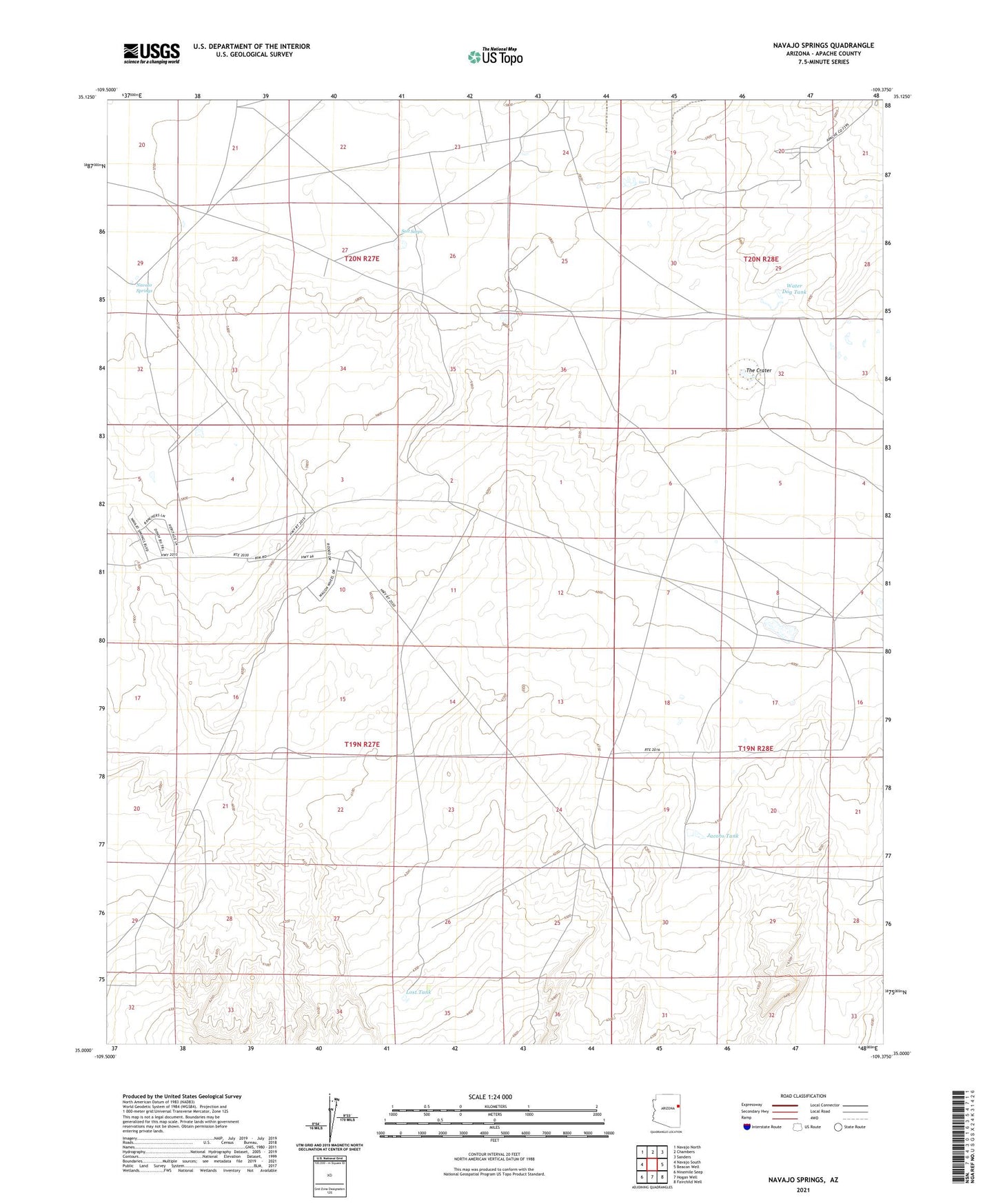
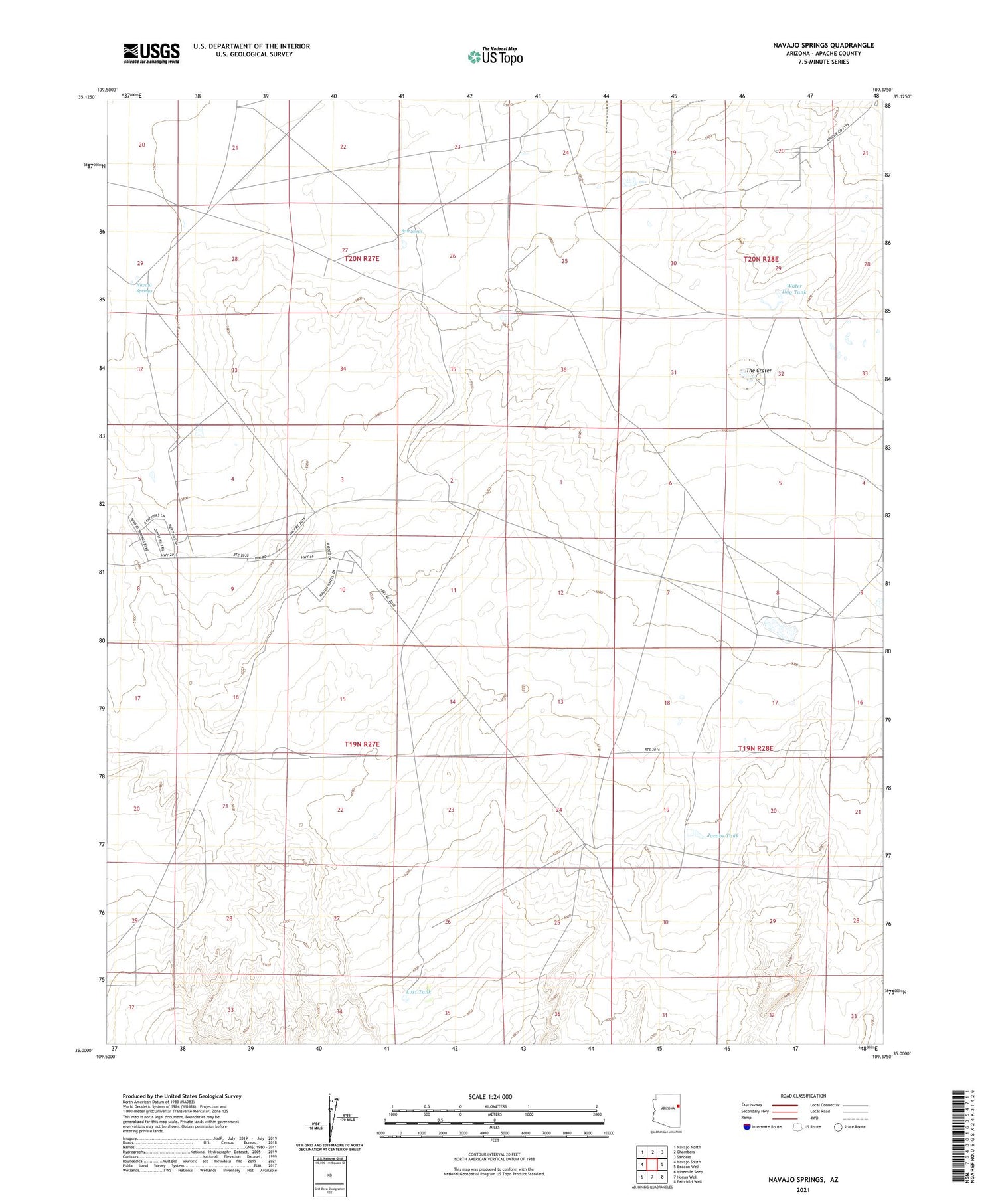
2021 topographic map quadrangle Navajo Springs in the state of Arizona. Scale: 1:24000. Based on the newly updated USGS 7.5' US Topo map series, this map is in the following counties: Apache. The map contains contour data, water features, and other items you are used to seeing on USGS maps, but also has updated roads and other features. This is the next generation of topographic maps. Printed on high-quality waterproof paper with UV fade-resistant inks.
Quads adjacent to this one:
West: Navajo South
Northwest: Navajo North
North: Chambers
Northeast: Sanders
East: Beacon Well
Southeast: Fairchild Well
South: Hogan Well
Southwest: Ninemile Seep
This map covers the same area as the classic USGS quad with code o35109a4.
Contains the following named places: Bobcat Windmill, Jacobs Tank, Jacobs Well, Little Wallace Windmill, Lost Tank, Navajo Springs, Rattlesnake Windmill, Salt Seeps, Sleepy Hollow Windmill, Teclote Windmill, Territorial Government Formation Site Historical Monument, The Crater, Water Dog Tank