MyTopo
North of Roll Arizona US Topo Map
Couldn't load pickup availability
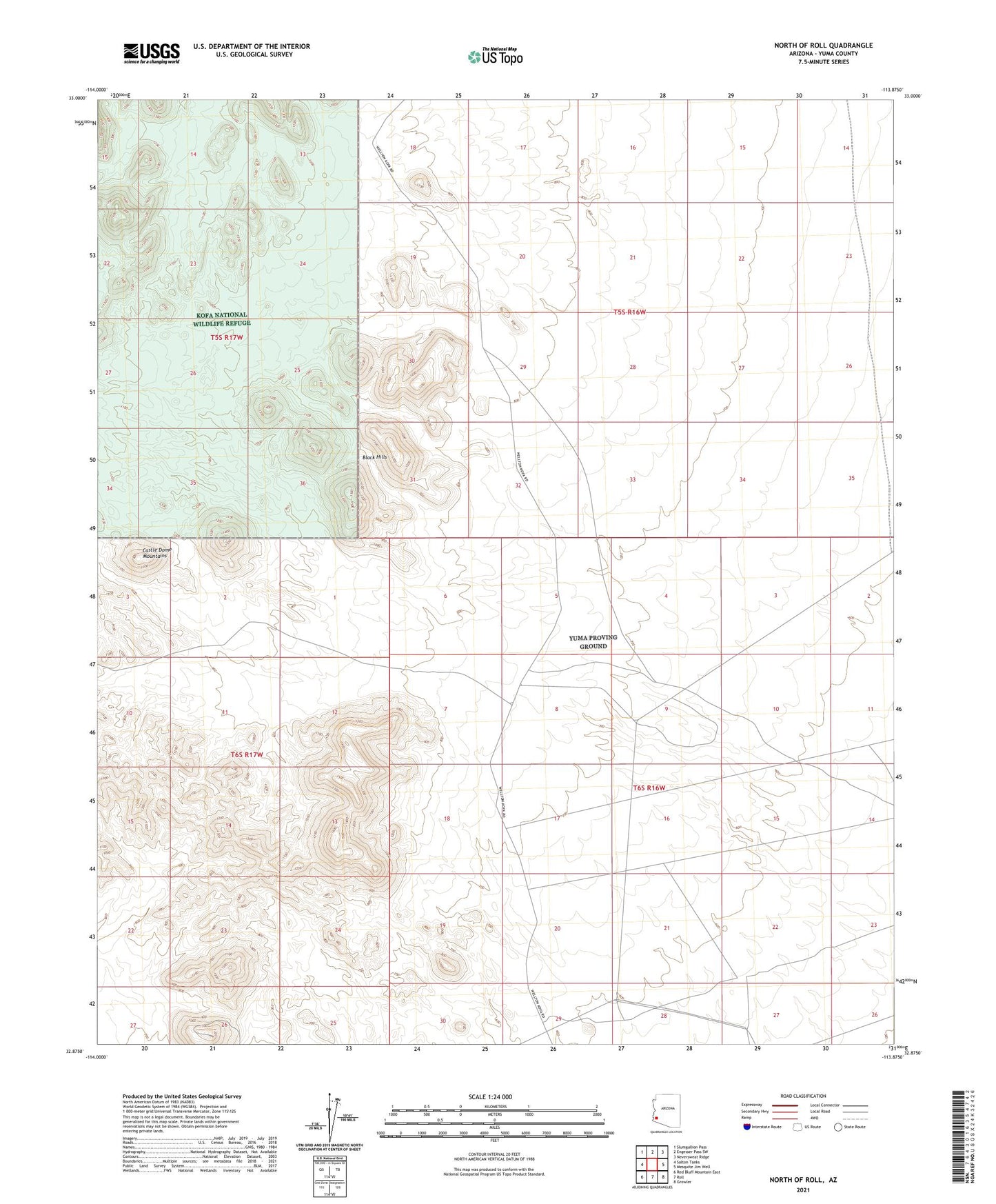
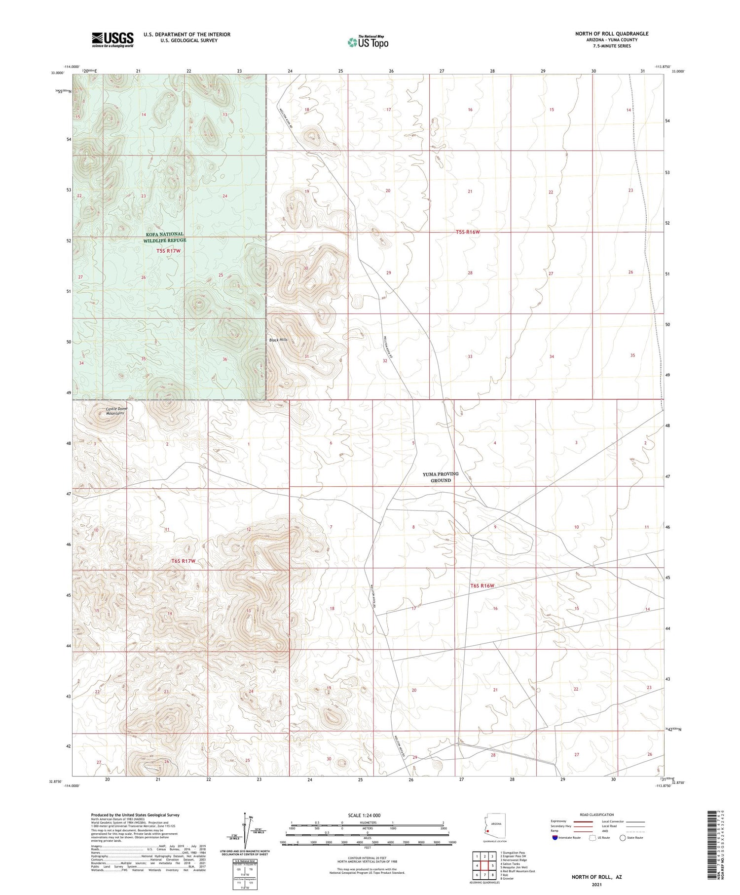
2021 topographic map quadrangle North of Roll in the state of Arizona. Scale: 1:24000. Based on the newly updated USGS 7.5' US Topo map series, this map is in the following counties: Yuma. The map contains contour data, water features, and other items you are used to seeing on USGS maps, but also has updated roads and other features. This is the next generation of topographic maps. Printed on high-quality waterproof paper with UV fade-resistant inks.
Quads adjacent to this one:
West: Salton Tanks
Northwest: Slumgullion Pass
North: Engesser Pass SW
Northeast: Neversweat Ridge
East: Mesquite Jim Well
Southeast: Growler
South: Roll
Southwest: Red Bluff Mountain East
This map covers the same area as the classic USGS quad with code o32113h8.
Contains the following named places: Black Hills, Norton Tank, Sheep Mine