MyTopo
Slumgullion Pass Arizona US Topo Map
Couldn't load pickup availability
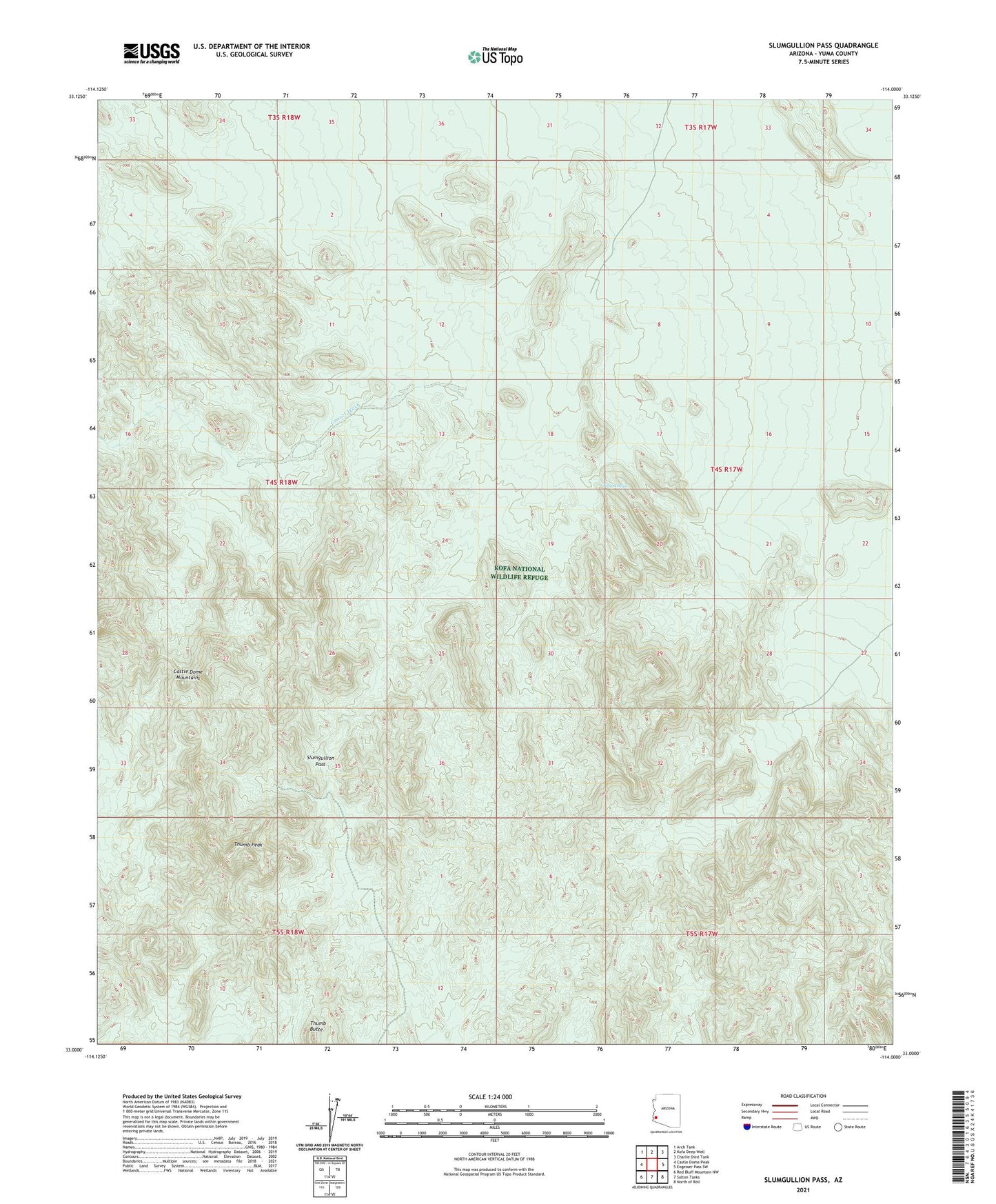
2021 topographic map quadrangle Slumgullion Pass in the state of Arizona. Scale: 1:24000. Based on the newly updated USGS 7.5' US Topo map series, this map is in the following counties: Yuma. The map contains contour data, water features, and other items you are used to seeing on USGS maps, but also has updated roads and other features. This is the next generation of topographic maps. Printed on high-quality waterproof paper with UV fade-resistant inks.
Quads adjacent to this one:
West: Castle Dome Peak
Northwest: Arch Tank
North: Kofa Deep Well
Northeast: Charlie Died Tank
East: Engesser Pass SW
Southeast: North of Roll
South: Salton Tanks
Southwest: Red Bluff Mountain NW
This map covers the same area as the classic USGS quad with code o33114a1.
Contains the following named places: Adams Well, Big Eye Mine, Blue Rock Tank, Castle Rock Dam, Castle Rock Tank, Chain Tank, Gravel Wash, Ketcherside Dam, Keystone Mine, Red Tank, Slumgullion Pass, Thumb Butte, Thumb Peak, Tinaja Sega