MyTopo
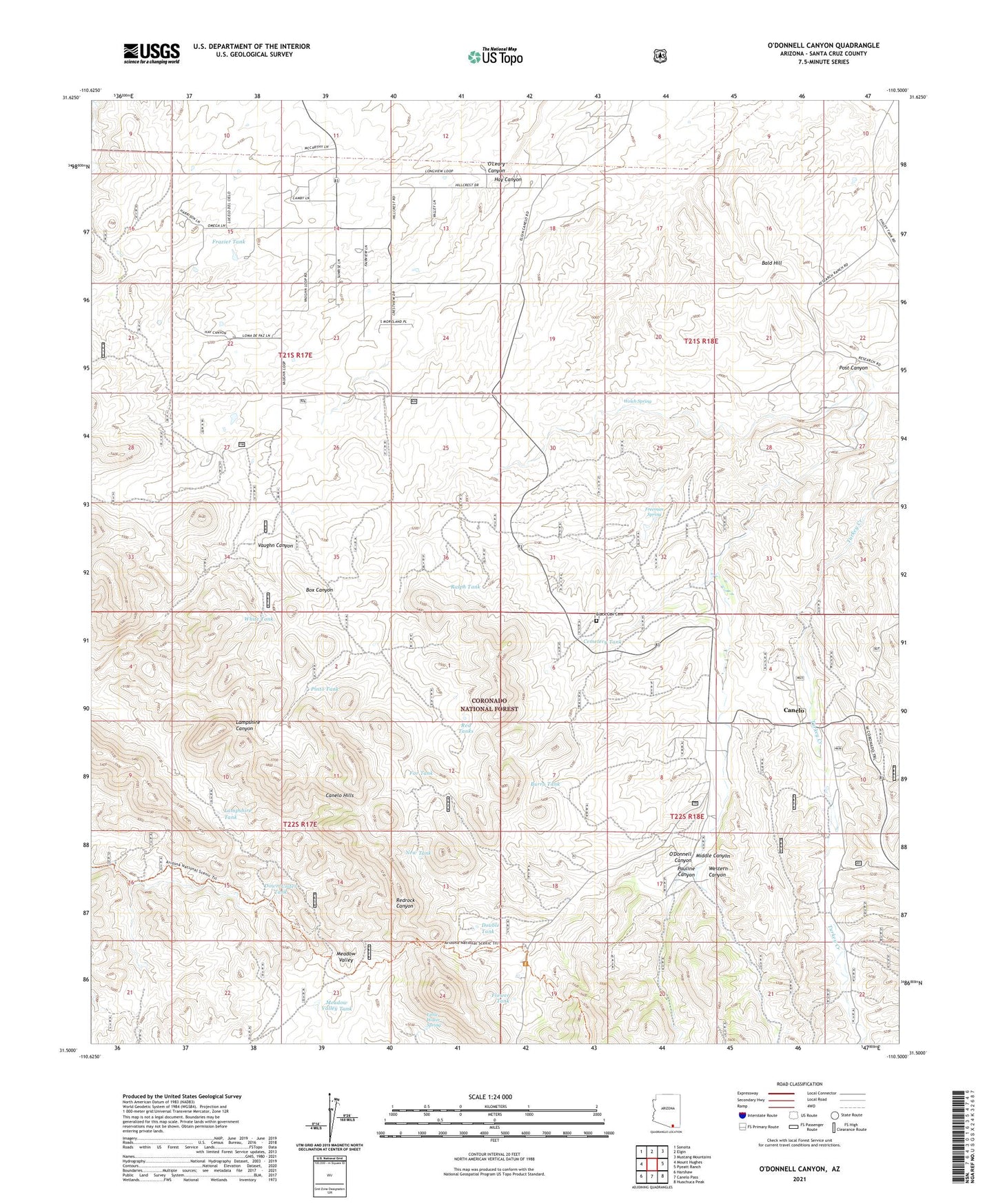
O'Donnell Canyon Arizona US Topo Map
Couldn't load pickup availability
Also explore the O'Donnell Canyon Forest Service Topo of this same quad for updated USFS data
2021 topographic map quadrangle O'Donnell Canyon in the state of Arizona. Scale: 1:24000. Based on the newly updated USGS 7.5' US Topo map series, this map is in the following counties: Santa Cruz. The map contains contour data, water features, and other items you are used to seeing on USGS maps, but also has updated roads and other features. This is the next generation of topographic maps. Printed on high-quality waterproof paper with UV fade-resistant inks.
Quads adjacent to this one:
West: Mount Hughes
Northwest: Sonoita
North: Elgin
Northeast: Mustang Mountains
East: Pyeatt Ranch
Southeast: Huachuca Peak
South: Canelo Pass
Southwest: Harshaw
Contains the following named places: Baker Ranch, Bald Hill, Black Oak Cemetery, Burro Tank, Canby Ranch, Canelo, Canelo Hills, Canelo Hills Ranch, Canelo Pass, Canelo Ranger Station, Canelo Trail Head, Canille School, Cemetery Tank, Clark Ranch, Collie Well, Dirt Tank, Double Tank, Down Under Tank, Everhart Ranch, Ewing Ranch, Far Tank, Fish Tank, Flower Tank, Forest Tank, Fort Tank, Frazier Ranch, Frazier Tank, Freeman Spring, Freeman Well, Glotts Tank, Guy Tank, Houston Ranch, Issacs Well, La Plata Mine, La Plato Well, Lampshire Tank, Lampshire Well, Lee Stock Tank, Little Water Spring, Lower Pauline Trick Tank, Meadow Valley Mine, Meadow Valley Tank, Middle Canyon, New Tank, New Well, New York Mine, North Forest Well, North Unit Stock Tank, Oak Well, O'Leary Canyon, Parker Ranch, Pauline Canyon, Pauline Well, Pinto Tank, Post Canyon, Post Well, Ralph Tank, Rattlesnake Dam, Red Tanks, Research Ranch Headquarters, Roath Ranch, Rogers Well, Triangle Ranch, Umpire Ranch, Welch Spring, West Tank, Western Canyon, Western Well, White Tank, Whitney Ranch, Wood Ranch