
MyTopo
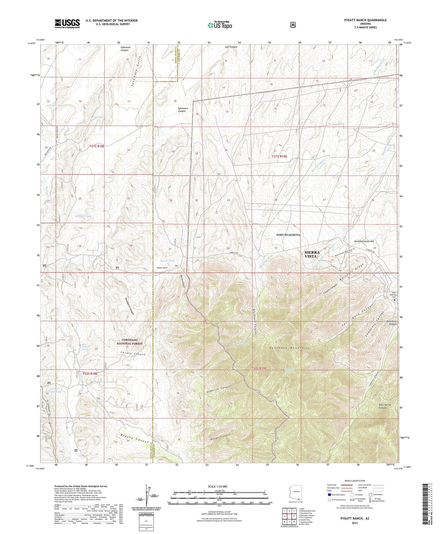
Pyeatt Ranch Arizona US Topo Map
Couldn't load pickup availability
Also explore the Pyeatt Ranch Forest Service Topo of this same quad for updated USFS data
2021 topographic map quadrangle Pyeatt Ranch in the state of Arizona. Scale: 1:24000. Based on the newly updated USGS 7.5' US Topo map series, this map is in the following counties: Cochise, Santa Cruz. The map contains contour data, water features, and other items you are used to seeing on USGS maps, but also has updated roads and other features. This is the next generation of topographic maps. Printed on high-quality waterproof paper with UV fade-resistant inks.
Quads adjacent to this one:
Northwest: Elgin
North: Mustang Mountains
Northeast: Huachuca City
East: Fort Huachuca
Southeast: Miller Peak
South: Huachuca Peak
Southwest: Canelo Pass
This map covers the same area as the classic USGS quad with code o31110e4.
Contains the following named places: Algerita Canyon, Anderson Mine, Becker Ranch, Blacktail Canyon, Blacktail Spring, Boss Ranch, Brushy Canyon, Buffalo Corral, Bull Pasture Spring, Cemetery Canyon, Coyote Canyon, Deer Spring, Demonstration Hill, East Tank, Ferosa Canyon, Finley Tank, Flying B Ranch, Fort Huachuca Cemetery, George Stock Tank, Jay Tank, Kino Spring, Manila Canyon, Manila Mine, Marshall Ridge, McDaniel Well, Mesa Tank, North Tank, Page Ranch, Pyeatt Ranch, Pyeatt Tank, Roadside Well, Rough Canyon, South Tank, Split Rock Canyon, Swinging H Ranch, Sycamore Canyon, Sycamore Gulch, Turkey Creek, Woodyard Canyon, ZIP Code: 85613


