MyTopo
Pinon Arizona US Topo Map
Couldn't load pickup availability
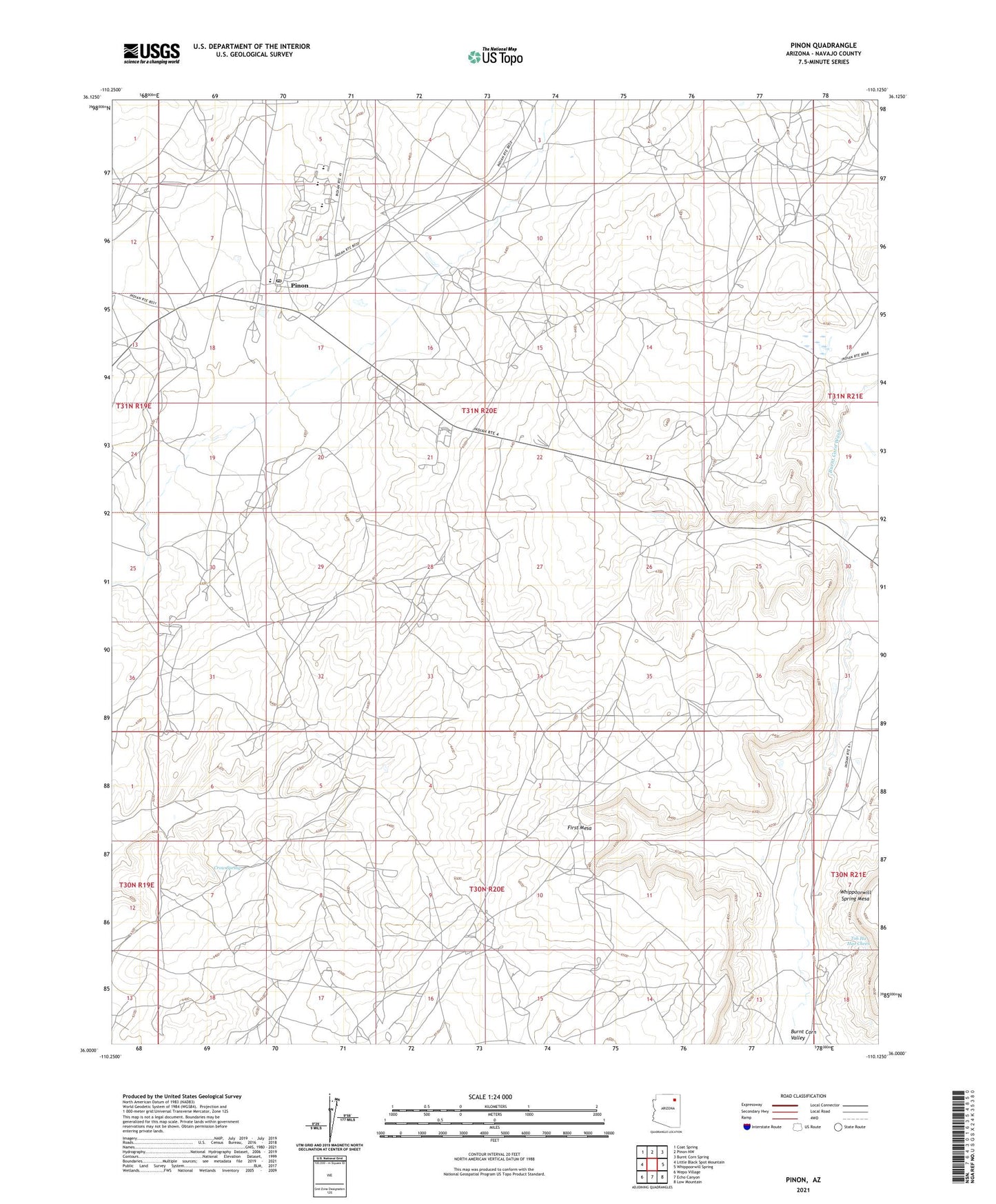
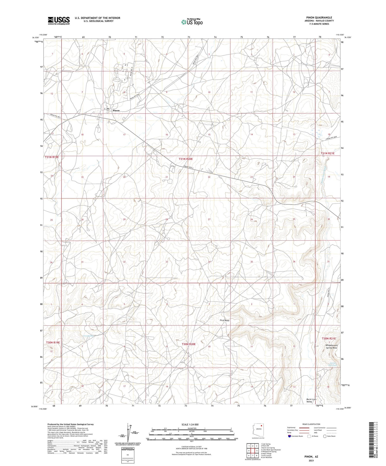
2021 topographic map quadrangle Pinon in the state of Arizona. Scale: 1:24000. Based on the newly updated USGS 7.5' US Topo map series, this map is in the following counties: Navajo. The map contains contour data, water features, and other items you are used to seeing on USGS maps, but also has updated roads and other features. This is the next generation of topographic maps. Printed on high-quality waterproof paper with UV fade-resistant inks.
Quads adjacent to this one:
West: Little Black Spot Mountain
Northwest: Coat Spring
North: Pinon NW
Northeast: Burnt Corn Spring
East: Whippoorwill Spring
Southeast: Low Mountain
South: Echo Canyon
Southwest: Wepo Village
This map covers the same area as the classic USGS quad with code o36110a2.
Contains the following named places: Burnt Corn Valley, Co-op Trading Post, Crow Spring, Pinon, Pinon Airport, Pinon Boarding School, Pinon Census Designated Place, Pinon Chapter, Pinon Chapter House, Pinon Elementary School, Pinon High School, Pinon Middle School, Pinon Post Office, Pinon Rodeo Grounds, Pinon Trading Post, Round Valley Trading Post, Sagebrush Well, Toh Ha Hao Cheen