MyTopo
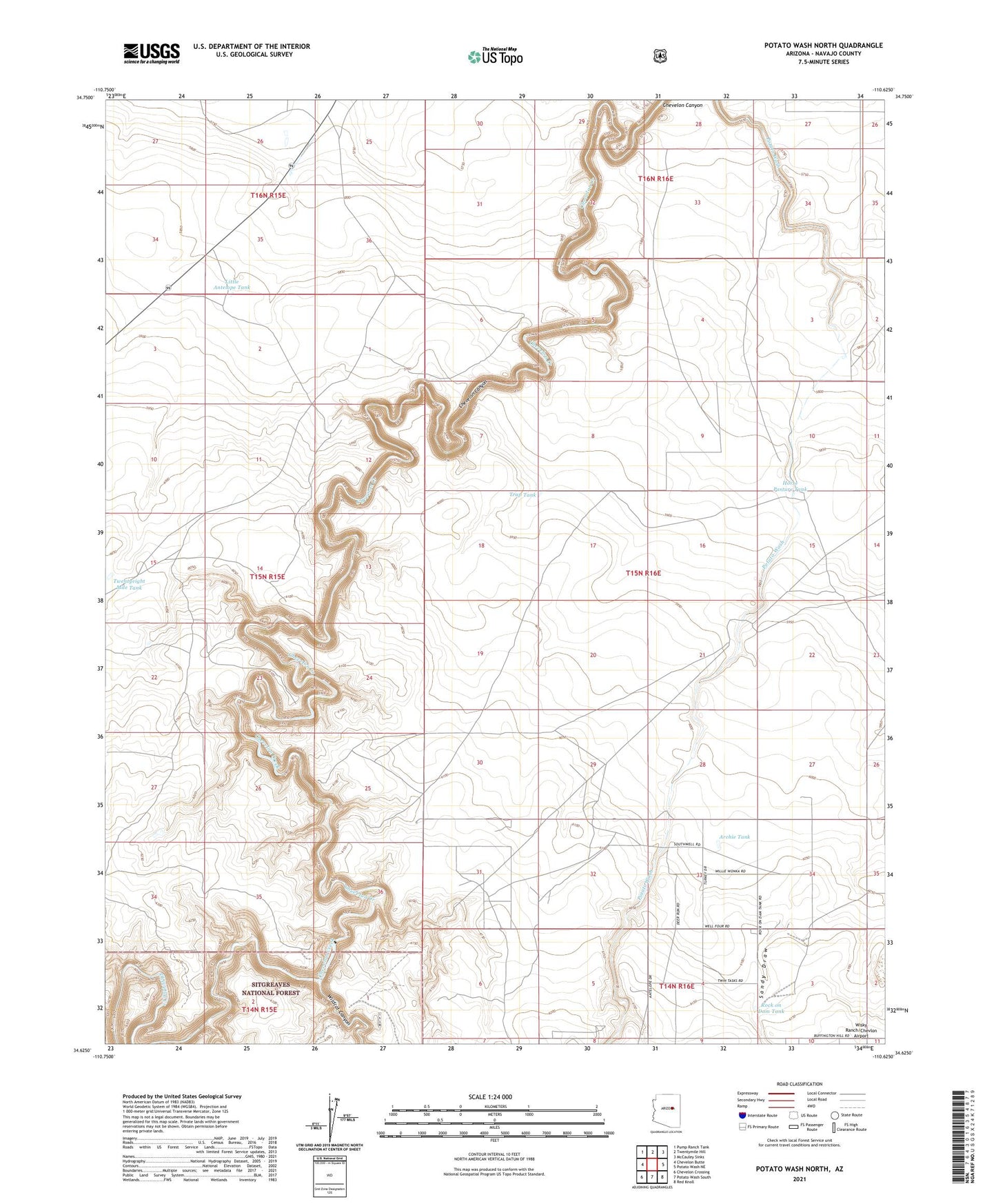
Potato Wash North Arizona US Topo Map
Couldn't load pickup availability
Also explore the Potato Wash North Forest Service Topo of this same quad for updated USFS data
2021 topographic map quadrangle Potato Wash North in the state of Arizona. Scale: 1:24000. Based on the newly updated USGS 7.5' US Topo map series, this map is in the following counties: Navajo. The map contains contour data, water features, and other items you are used to seeing on USGS maps, but also has updated roads and other features. This is the next generation of topographic maps. Printed on high-quality waterproof paper with UV fade-resistant inks.
Quads adjacent to this one:
West: Chevelon Butte
Northwest: Pump Ranch Tank
North: Twentymile Hill
Northeast: McCauley Sinks
East: Potato Wash NE
Southeast: Red Knoll
South: Potato Wash South
Southwest: Chevelon Crossing
This map covers the same area as the classic USGS quad with code o34110f6.
Contains the following named places: Antelope Tank, Archie Tank, Buck Tank, Durant Tank, Horse Pasture Tank, Little Antelope Tank, Mitchell Windmill, Points of Wildcat, Rock on Dam Tank, Rock Tank, Sandy Draw, Trap Tank, Twentyeight Mile Tank, Wildcat Canyon