MyTopo
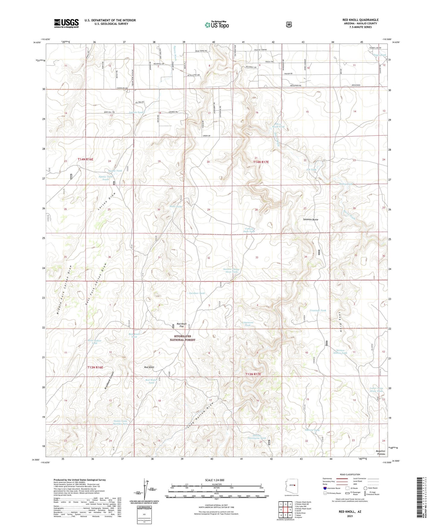
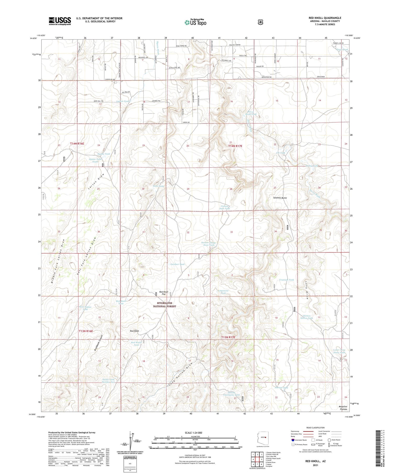
Red Knoll Arizona US Topo Map
Couldn't load pickup availability
Also explore the Red Knoll Forest Service Topo of this same quad for updated USFS data
2023 topographic map quadrangle Red Knoll in the state of Arizona. Scale: 1:24000. Based on the newly updated USGS 7.5' US Topo map series, this map is in the following counties: Navajo. The map contains contour data, water features, and other items you are used to seeing on USGS maps, but also has updated roads and other features. This is the next generation of topographic maps. Printed on high-quality waterproof paper with UV fade-resistant inks.
Quads adjacent to this one:
West: Potato Wash South
Northwest: Potato Wash North
North: Potato Wash NE
Northeast: Dry Lake NW
East: Zeniff
Southeast: Aripine
South: Heber
Southwest: Hanks Draw
This map covers the same area as the classic USGS quad with code o34110e5.
Contains the following named places: Ancient Tank, Brookbank Canyon, Cement Dam Tank, E S Tank, East Fork Larson Draw, Gardner Tank, Larson Draw, Larson Tank, Limestone Tank, Long Draw, Long Hollow Draw, Lower Long Draw Tank, Lower Trick Tank, Middle Fork Larson Draw, North Trick Tank, Petes Tank, Pierce Wash, Pierce Wash Tank, Poyer Tank, Red Knoll, Red Knoll Flat, Red Knoll Flat Tank, Red Knoll Tank, Red Knoll Well, Red Water Tank, Section Eleven Tank, Section Thirty-three Tank, Section Twentyone Tank, Solomon Butte, Squaw Tank, Squaw Tank South, Stolen Tank Number Two, Turley Tank, Uranium Tank, West Indian Tank, ZIP Code: 85928