MyTopo
Santa Rosa Mountains SE Arizona US Topo Map
Couldn't load pickup availability
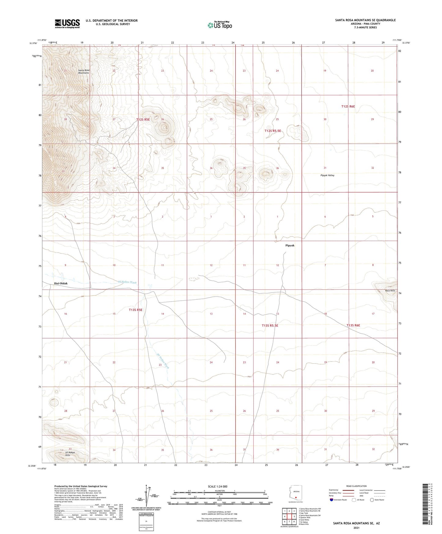
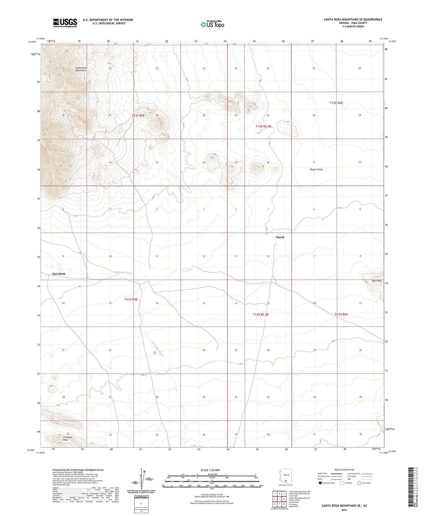
2021 topographic map quadrangle Santa Rosa Mountains SE in the state of Arizona. Scale: 1:24000. Based on the newly updated USGS 7.5' US Topo map series, this map is in the following counties: Pima. The map contains contour data, water features, and other items you are used to seeing on USGS maps, but also has updated roads and other features. This is the next generation of topographic maps. Printed on high-quality waterproof paper with UV fade-resistant inks.
Quads adjacent to this one:
West: Santa Rosa Mountains SW
Northwest: Santa Rosa Mountains NW
North: Santa Rosa Mountains NE
Northeast: Gap Tank
East: Queens Well
Southeast: Black Hills
South: Sil Nakya
Southwest: Sand Wells
This map covers the same area as the classic USGS quad with code o32111c7.
Contains the following named places: Hoi Oidak, Pipyak, Pipyak Valley