MyTopo
Seligman West Arizona US Topo Map
Couldn't load pickup availability
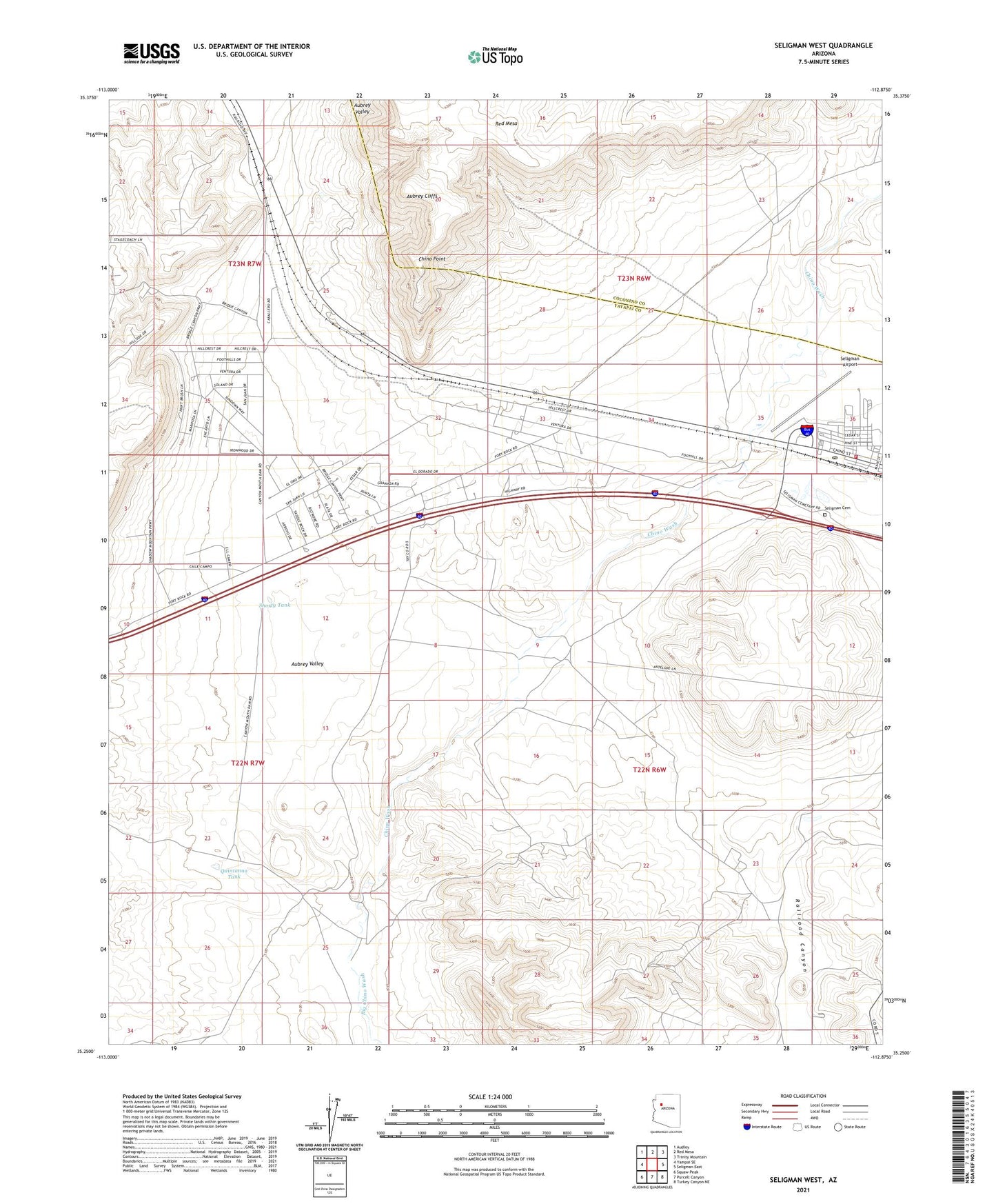
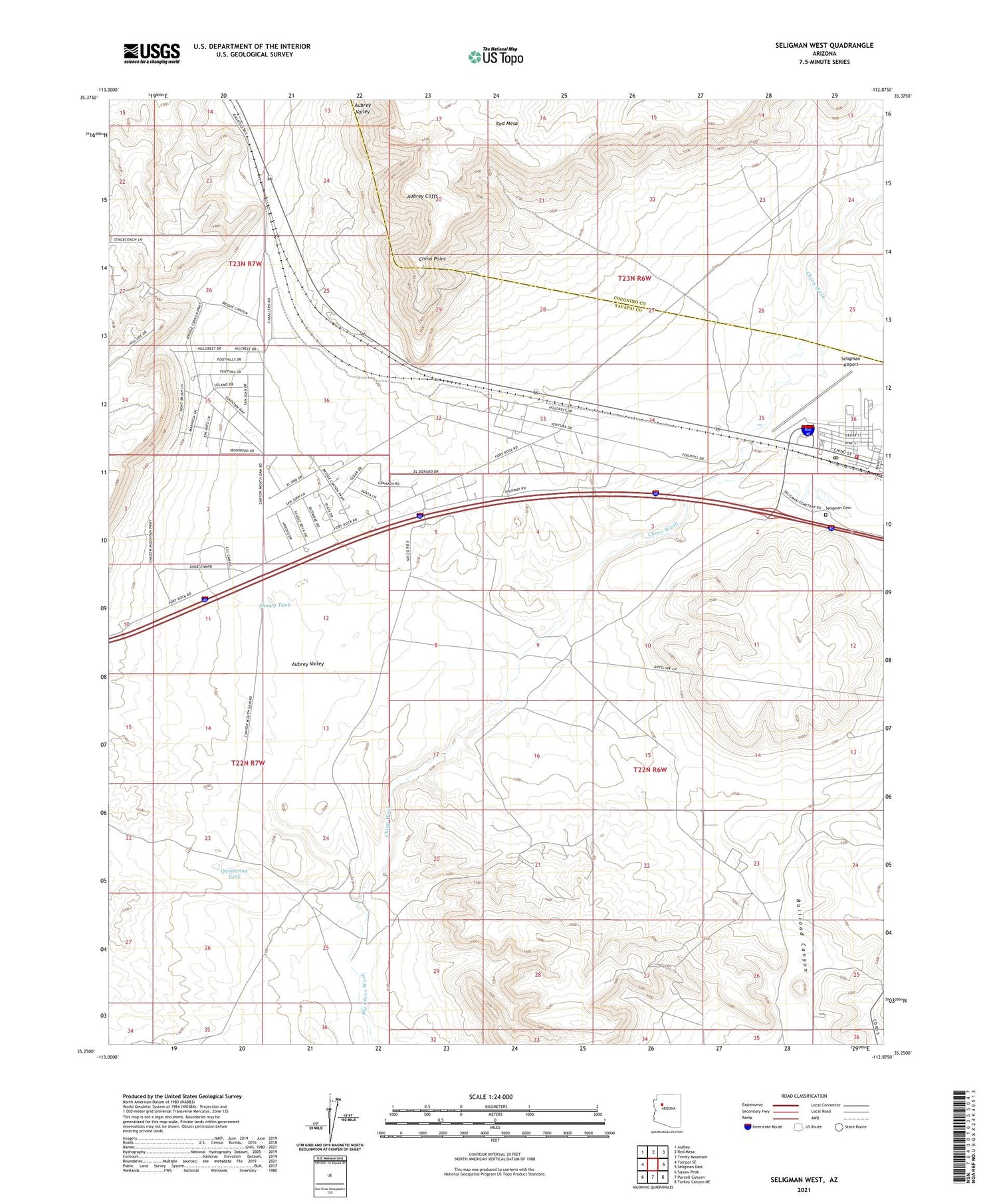
2021 topographic map quadrangle Seligman West in the state of Arizona. Scale: 1:24000. Based on the newly updated USGS 7.5' US Topo map series, this map is in the following counties: Yavapai, Coconino. The map contains contour data, water features, and other items you are used to seeing on USGS maps, but also has updated roads and other features. This is the next generation of topographic maps. Printed on high-quality waterproof paper with UV fade-resistant inks.
Quads adjacent to this one:
West: Yampai SE
Northwest: Audley
North: Red Mesa
Northeast: Trinity Mountain
East: Seligman East
Southeast: Turkey Canyon NE
South: Purcell Canyon
Southwest: Squaw Peak
This map covers the same area as the classic USGS quad with code o35112c8.
Contains the following named places: Aubrey Valley, Buck Rogers Well, Canyon Mouth Dam, Chino Point, Chino Station, Chino Wash, Chino Well, Fox Dam, Quintanna Tank, Railroad Embankment, Railroad Embankment Reservoir, Red Mesa, Santa Fe Wells, Seligman, Seligman Airport, Seligman Cemetery, Seligman Dam, Seligman Fire District, Seligman Post Office, Seligman Railroad Station, Shorty Tank