MyTopo
Yampai SE Arizona US Topo Map
Couldn't load pickup availability
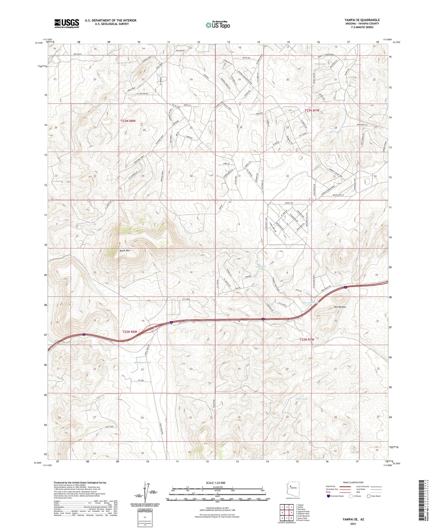
2021 topographic map quadrangle Yampai SE in the state of Arizona. Scale: 1:24000. Based on the newly updated USGS 7.5' US Topo map series, this map is in the following counties: Yavapai. The map contains contour data, water features, and other items you are used to seeing on USGS maps, but also has updated roads and other features. This is the next generation of topographic maps. Printed on high-quality waterproof paper with UV fade-resistant inks.
Quads adjacent to this one:
West: Sugarloaf Peak
Northwest: Yampai
North: Audley
Northeast: Red Mesa
East: Seligman West
Southeast: Purcell Canyon
South: Squaw Peak
Southwest: Cross Mountain
This map covers the same area as the classic USGS quad with code o35113c1.
Contains the following named places: Black Mountain, Black Mountain Well, Freeway Tank, Limestone Well, Lindburg Tank, Lost Tank, Markham Well, Pet Tank, Slurry Pond Number One, Slurry Pond Number One Dam, Twin Buttes, ZIP Code: 86337