MyTopo
Sunflower Butte Arizona US Topo Map
Couldn't load pickup availability
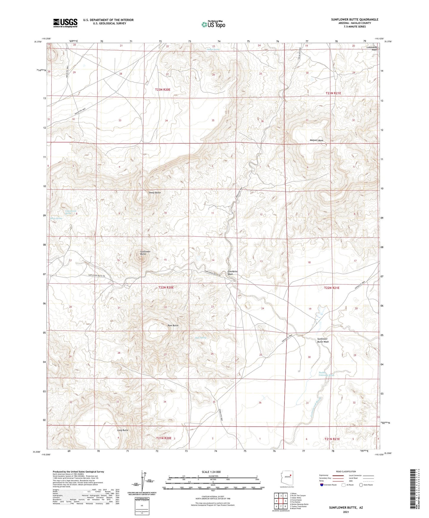
2021 topographic map quadrangle Sunflower Butte in the state of Arizona. Scale: 1:24000. Based on the newly updated USGS 7.5' US Topo map series, this map is in the following counties: Navajo. The map contains contour data, water features, and other items you are used to seeing on USGS maps, but also has updated roads and other features. This is the next generation of topographic maps. Printed on high-quality waterproof paper with UV fade-resistant inks.
Quads adjacent to this one:
West: French Butte
Northwest: Dilkon
North: Na Ah Tee Canyon
Northeast: Indian Wells
East: Five Buttes
Southeast: Mitten Peak
South: Turkey Track Butte
Southwest: Rotten Bananas Butte
This map covers the same area as the classic USGS quad with code o35110c2.
Contains the following named places: Cottonwood Spring, Dalkai Spring, Gleshbito Wash, Long Butte, Malpais Mesa, Pueblo Colorado Wash, Ram Butte, Ram Spring, Sheep Butte, Sheep Spring, Sunflower Butte, Sunflower Butte Wash, Sunflower Butte Well