MyTopo
Dilkon Arizona US Topo Map
Couldn't load pickup availability
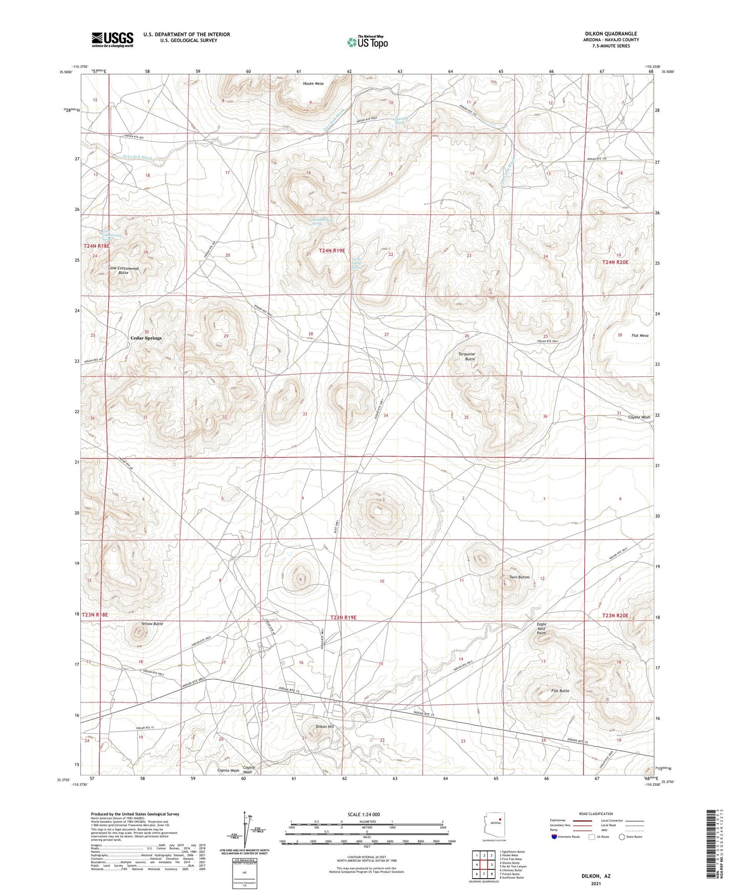
2021 topographic map quadrangle Dilkon in the state of Arizona. Scale: 1:24000. Based on the newly updated USGS 7.5' US Topo map series, this map is in the following counties: Navajo. The map contains contour data, water features, and other items you are used to seeing on USGS maps, but also has updated roads and other features. This is the next generation of topographic maps. Printed on high-quality waterproof paper with UV fade-resistant inks.
Quads adjacent to this one:
West: Shonto Butte
Northwest: Egloffstein Butte
North: Hauke Mesa
Northeast: First Flat Mesa
East: Na Ah Tee Canyon
Southeast: Sunflower Butte
South: French Butte
Southwest: Chimney Butte
This map covers the same area as the classic USGS quad with code o35110d3.
Contains the following named places: Cedar Springs, Dilkon, Dilkon Hill, Eagle Nest Point, Flat Butte, Flat Mesa, Indian Wells Division, Lone Cottonwood Butte, Lone Cottonwood Spring, Mountainside Spring, Navajo County, Tees Toh Spring, Tsi Na Jinnie Spring, Turquoise Butte, Twin Buttes, Yellow Butte