MyTopo
Swisshelm Mountain Arizona US Topo Map
Couldn't load pickup availability
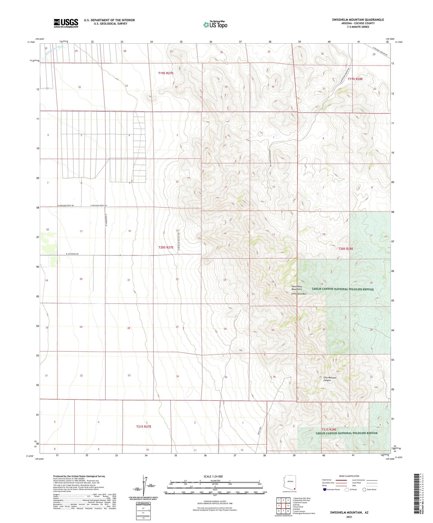
2021 topographic map quadrangle Swisshelm Mountain in the state of Arizona. Scale: 1:24000. Based on the newly updated USGS 7.5' US Topo map series, this map is in the following counties: Cochise. The map contains contour data, water features, and other items you are used to seeing on USGS maps, but also has updated roads and other features. This is the next generation of topographic maps. Printed on high-quality waterproof paper with UV fade-resistant inks.
Quads adjacent to this one:
West: Elfrida
Northwest: Squaretop Hills West
North: Squaretop Hills East
Northeast: Stanford Canyon
East: Bruno Peak
Southeast: Pedregosa Mountains West
South: Leslie Canyon
Southwest: McNeal
This map covers the same area as the classic USGS quad with code o31109f5.
Contains the following named places: Swisshelm Lodge, Swisshelm Mountain, Swisshelm Mountains