MyTopo
Elfrida Arizona US Topo Map
Couldn't load pickup availability
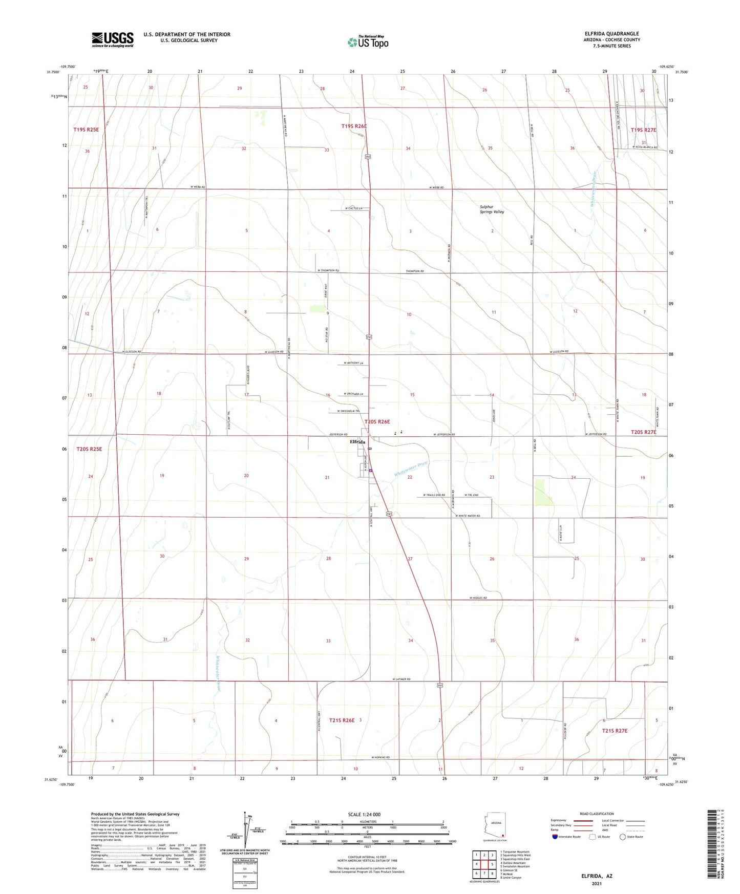
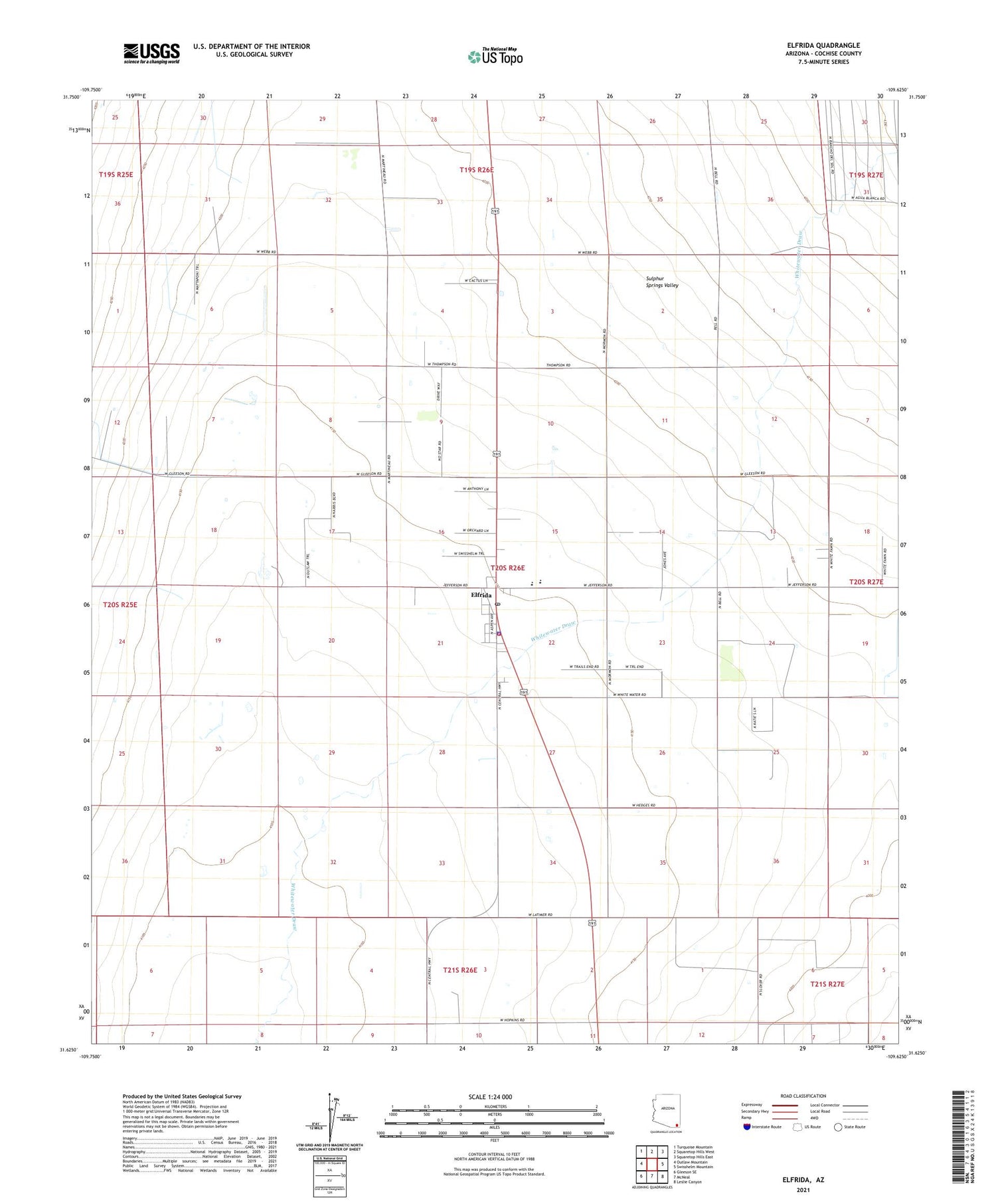
2021 topographic map quadrangle Elfrida in the state of Arizona. Scale: 1:24000. Based on the newly updated USGS 7.5' US Topo map series, this map is in the following counties: Cochise. The map contains contour data, water features, and other items you are used to seeing on USGS maps, but also has updated roads and other features. This is the next generation of topographic maps. Printed on high-quality waterproof paper with UV fade-resistant inks.
Quads adjacent to this one:
West: Outlaw Mountain
Northwest: Turquoise Mountain
North: Squaretop Hills West
Northeast: Squaretop Hills East
East: Swisshelm Mountain
Southeast: Leslie Canyon
South: McNeal
Southwest: Gleeson SE
This map covers the same area as the classic USGS quad with code o31109f6.
Contains the following named places: Cochise County Sheriff's Office Elfrida Patrol District, Cochise Eastern Regional Landfill, Elfrida, Elfrida Baptist Church, Elfrida Census Designated Place, Elfrida Elementary School, Elfrida Fire Department, Elfrida Library, Elfrida Post Office, Valley Union High School, ZIP Code: 85610