MyTopo
Truxton Arizona US Topo Map
Couldn't load pickup availability
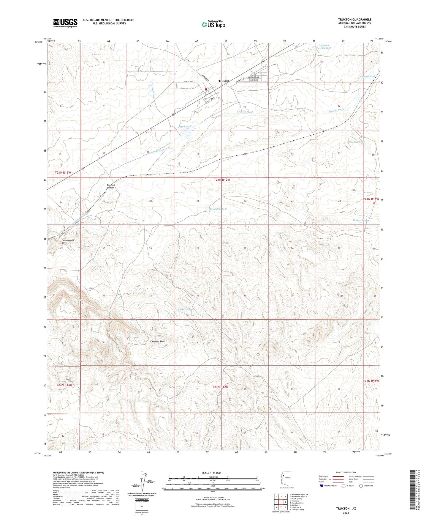
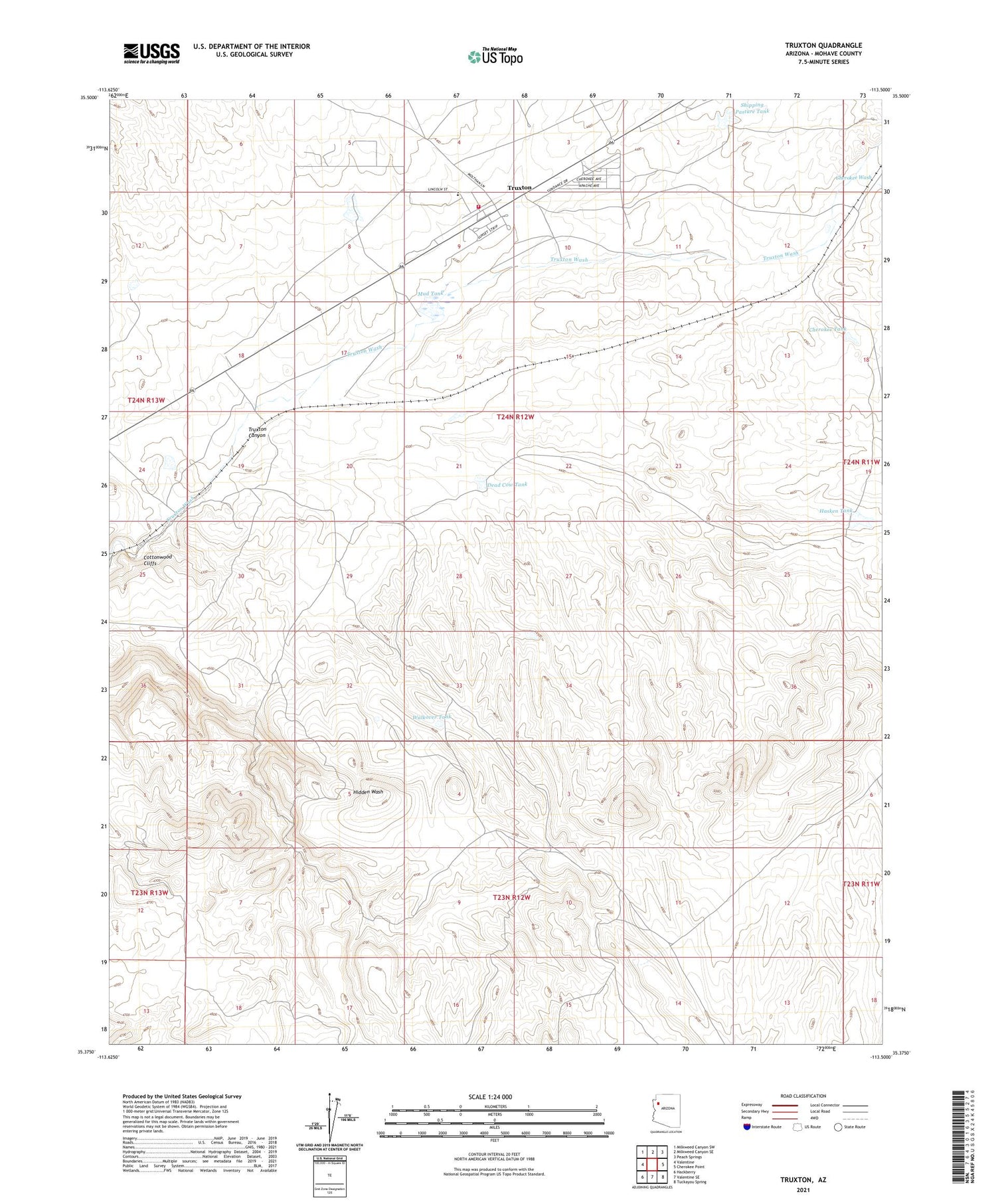
2021 topographic map quadrangle Truxton in the state of Arizona. Scale: 1:24000. Based on the newly updated USGS 7.5' US Topo map series, this map is in the following counties: Mohave. The map contains contour data, water features, and other items you are used to seeing on USGS maps, but also has updated roads and other features. This is the next generation of topographic maps. Printed on high-quality waterproof paper with UV fade-resistant inks.
Quads adjacent to this one:
West: Valentine
Northwest: Milkweed Canyon SW
North: Milkweed Canyon SE
Northeast: Peach Springs
East: Cherokee Point
Southeast: Tuckayou Spring
South: Valentine SE
Southwest: Hackberry
This map covers the same area as the classic USGS quad with code o35113d5.
Contains the following named places: Cherokee, Cherokee Tank, Cherokee Wash, Dead Cow Tank, Hasken Tank, Hidden Wash, Mud Tank, Northern Arizona Consolidated Fire District Station 38, Shipping Pasture Tank, Truxton, Truxton Census Designated Place, Truxton Railroad Station, Valentine Elementary School, W F Cattle Company Dam, Walkover Tank, ZIP Code: 86437