MyTopo
Tuckayou Spring Arizona US Topo Map
Couldn't load pickup availability
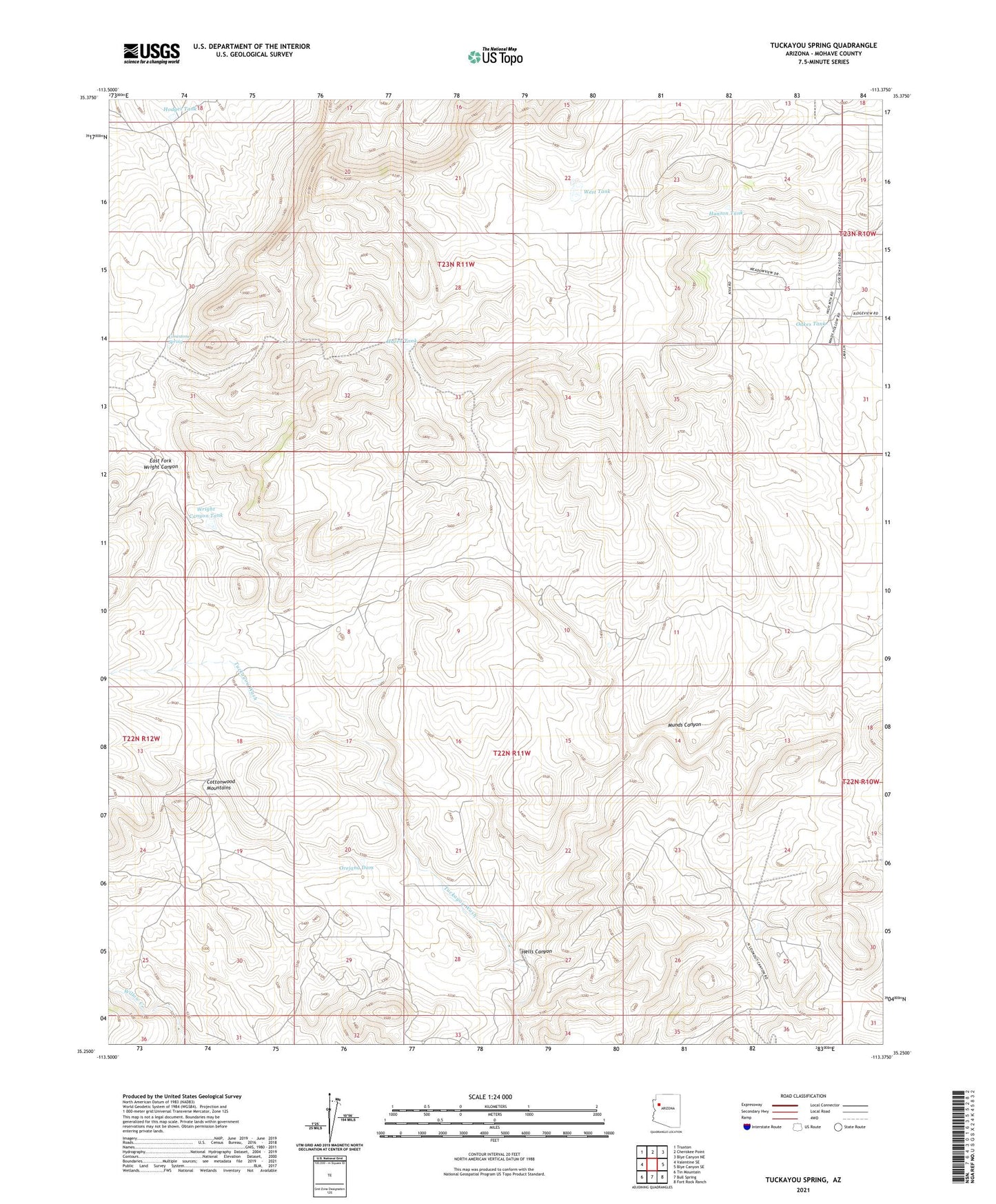
2021 topographic map quadrangle Tuckayou Spring in the state of Arizona. Scale: 1:24000. Based on the newly updated USGS 7.5' US Topo map series, this map is in the following counties: Mohave. The map contains contour data, water features, and other items you are used to seeing on USGS maps, but also has updated roads and other features. This is the next generation of topographic maps. Printed on high-quality waterproof paper with UV fade-resistant inks.
Quads adjacent to this one:
West: Valentine SE
Northwest: Truxton
North: Cherokee Point
Northeast: Blye Canyon NE
East: Blye Canyon SE
Southeast: Fort Rock Ranch
South: Bull Spring
Southwest: Tin Mountain
This map covers the same area as the classic USGS quad with code o35113c4.
Contains the following named places: East Fork Wright Canyon, Hanson Tank, Hazen Tank, Hells Canyon, Hells Canyon Tank, Hodges Tank, Limestone Spring, Maggie Dam, Maggie Well, Munds Canyon, Munds Tank, Munds Well, Oakes Tank, Orejana Dam, South Tank, West Tank, Wright Canyon Tank