MyTopo
Utting Arizona US Topo Map
Couldn't load pickup availability
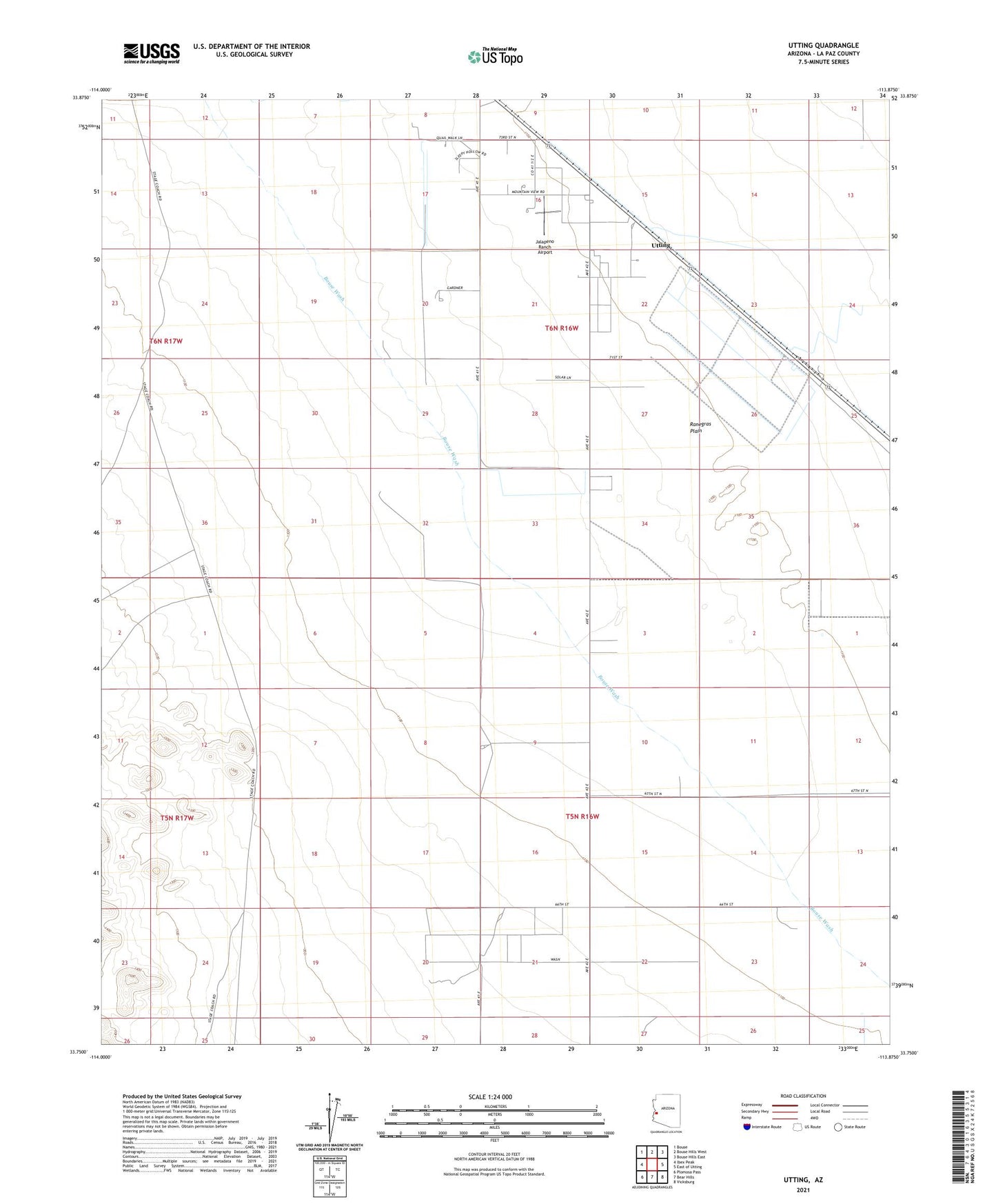
2021 topographic map quadrangle Utting in the state of Arizona. Scale: 1:24000. Based on the newly updated USGS 7.5' US Topo map series, this map is in the following counties: La Paz. The map contains contour data, water features, and other items you are used to seeing on USGS maps, but also has updated roads and other features. This is the next generation of topographic maps. Printed on high-quality waterproof paper with UV fade-resistant inks.
Quads adjacent to this one:
West: Ibex Peak
Northwest: Bouse
North: Bouse Hills West
Northeast: Bouse Hills East
East: East of Utting
Southeast: Vicksburg
South: Bear Hills
Southwest: Plomosa Pass
This map covers the same area as the classic USGS quad with code o33113g8.
Contains the following named places: Haynes Farm, Jalapeno Ranch Airport, Swadley Well, Utting, Utting Census Designated Place, Utting Siding Airstrip