MyTopo
Bear Hills Arizona US Topo Map
Couldn't load pickup availability
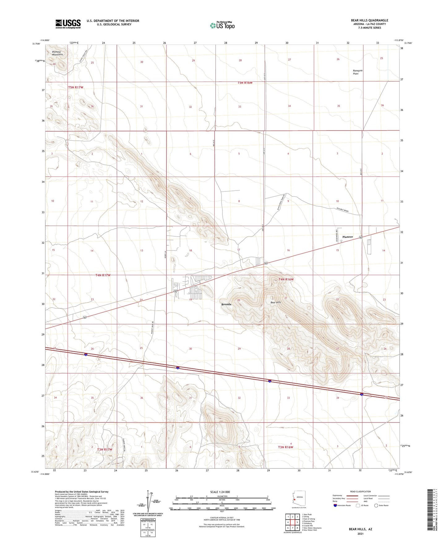
2021 topographic map quadrangle Bear Hills in the state of Arizona. Scale: 1:24000. Based on the newly updated USGS 7.5' US Topo map series, this map is in the following counties: La Paz. The map contains contour data, water features, and other items you are used to seeing on USGS maps, but also has updated roads and other features. This is the next generation of topographic maps. Printed on high-quality waterproof paper with UV fade-resistant inks.
Quads adjacent to this one:
West: Plomosa Pass
Northwest: Ibex Peak
North: Utting
Northeast: East of Utting
East: Vicksburg
Southeast: New Water Well
South: New Water Mountains
Southwest: Crystal Hill
This map covers the same area as the classic USGS quad with code o33113f8.
Contains the following named places: Bear Hills, Brenda, Brenda Census Designated Place, La Paz County, Parker Division, Pioneer, Plomosa Windmill, Ramsey Mine, Republic Mine, Shamrock Mine, The Black Rock Recreational Vehicle Village