MyTopo
Wellton Arizona US Topo Map
Couldn't load pickup availability
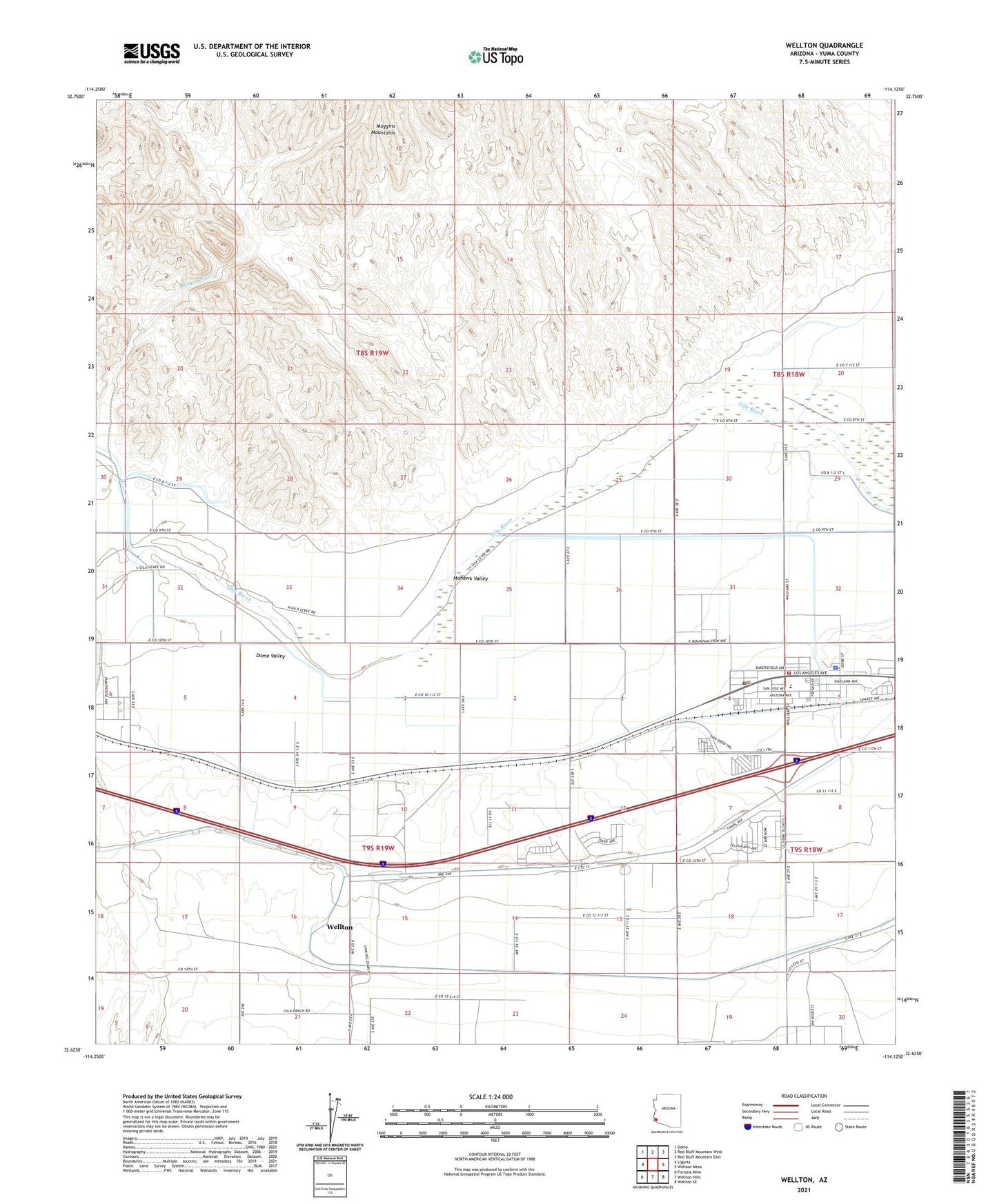
2021 topographic map quadrangle Wellton in the state of Arizona. Scale: 1:24000. Based on the newly updated USGS 7.5' US Topo map series, this map is in the following counties: Yuma. The map contains contour data, water features, and other items you are used to seeing on USGS maps, but also has updated roads and other features. This is the next generation of topographic maps. Printed on high-quality waterproof paper with UV fade-resistant inks.
Quads adjacent to this one:
West: Ligurta
Northwest: Dome
North: Red Bluff Mountain West
Northeast: Red Bluff Mountain East
East: Wellton Mesa
Southeast: Wellton SE
South: Wellton Hills
Southwest: Fortuna Mine
This map covers the same area as the classic USGS quad with code o32114f2.
Contains the following named places: Adonde, Butterfield Golf Course, Butterfield Park, Coyote Wash, Coyote Wash Channel, Dome Lateral, Grace Fellowship Church, Mohawk Valley, Morgan Wash, Muggins Mountains, The Links at Coyote Wash, Town of Wellton, Wellton, Wellton 4.2 Lateral, Wellton Assembly of God, Wellton Community Presbyterian Church, Wellton Elementary School, Wellton Fire Department, Wellton Library, Wellton Mohawk Main Channel, Wellton Post Office, Wellton Town Hall, Wellton Underpass, Yuma County Sheriff's Office District 5, ZIP Code: 85356