MyTopo
White Tank Mountains NE Arizona US Topo Map
Couldn't load pickup availability
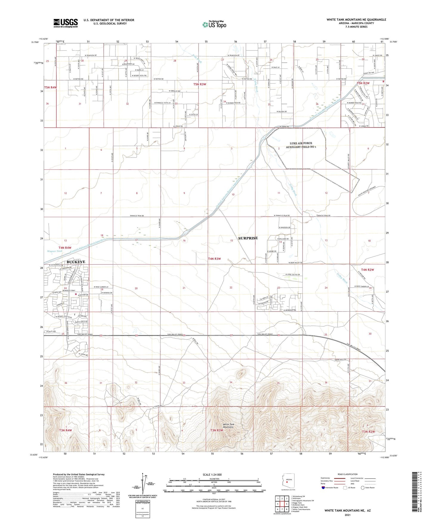
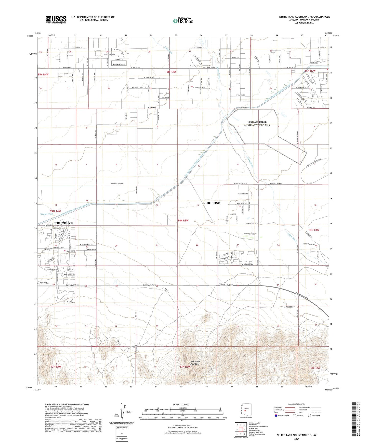
2021 topographic map quadrangle White Tank Mountains NE in the state of Arizona. Scale: 1:24000. Based on the newly updated USGS 7.5' US Topo map series, this map is in the following counties: Maricopa. The map contains contour data, water features, and other items you are used to seeing on USGS maps, but also has updated roads and other features. This is the next generation of topographic maps. Printed on high-quality waterproof paper with UV fade-resistant inks.
Quads adjacent to this one:
West: Daggs Tank
Northwest: Wickenburg SW
North: Wittmann
Northeast: Hieroglyphic Mountains SW
East: McMicken Dam
Southeast: Waddell
South: White Tank Mountains
Southwest: Wagner Wash Well
This map covers the same area as the classic USGS quad with code o33112f5.
Contains the following named places: Arizona Fire and Medical Authority Station 106, Buckeye Fire Department Station 704 Festival Ranch, Festival Foothills Elementary School, Iona Wash, Wagner Tank