MyTopo
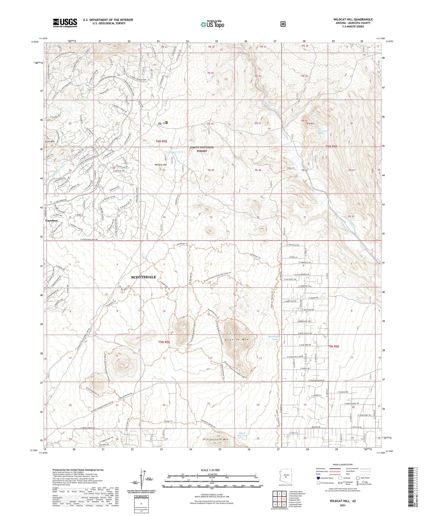
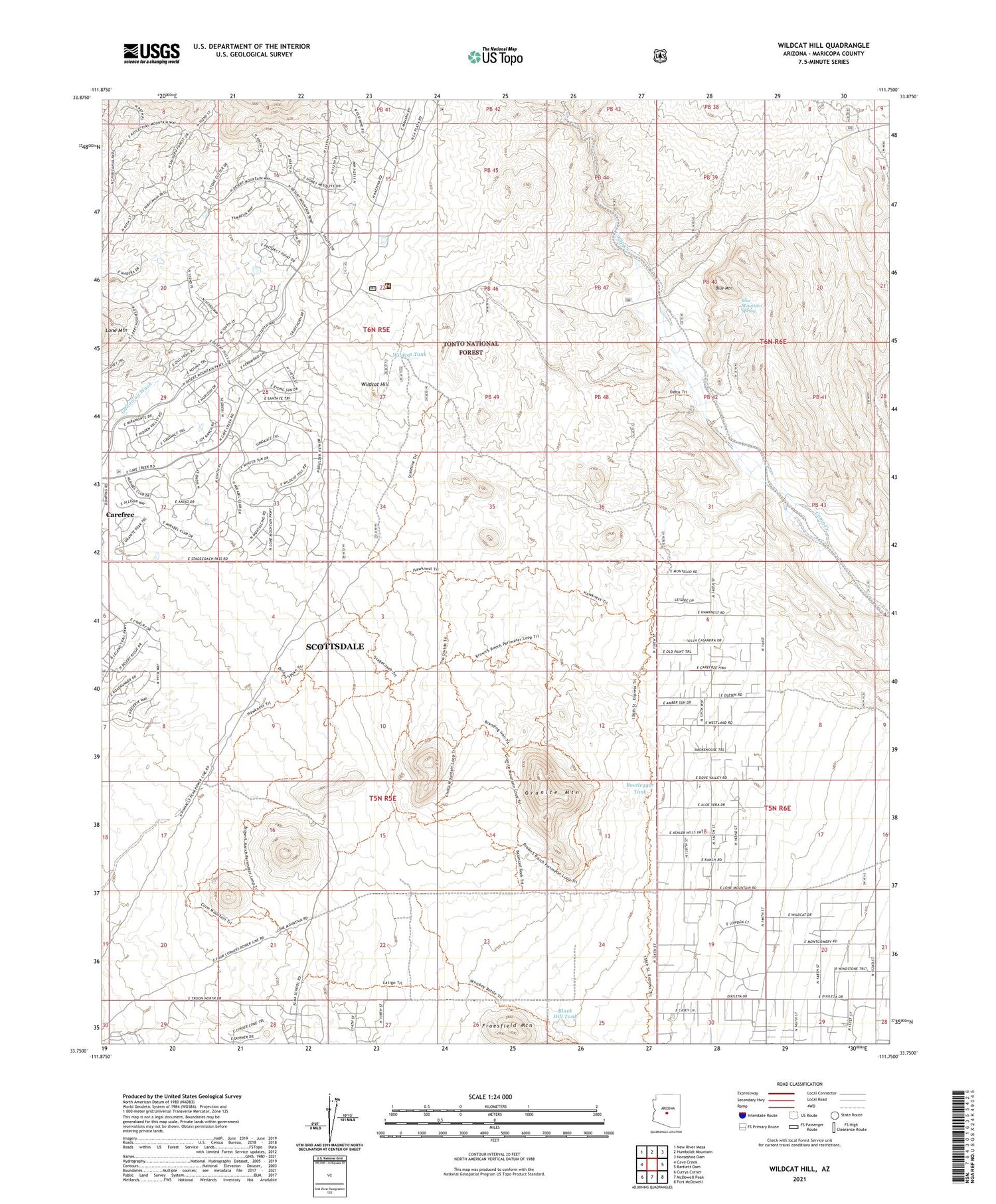
Wildcat Hill Arizona US Topo Map
Couldn't load pickup availability
Also explore the Wildcat Hill Forest Service Topo of this same quad for updated USFS data
2021 topographic map quadrangle Wildcat Hill in the state of Arizona. Scale: 1:24000. Based on the newly updated USGS 7.5' US Topo map series, this map is in the following counties: Maricopa. The map contains contour data, water features, and other items you are used to seeing on USGS maps, but also has updated roads and other features. This is the next generation of topographic maps. Printed on high-quality waterproof paper with UV fade-resistant inks.
Quads adjacent to this one:
West: Cave Creek
Northwest: New River Mesa
North: Humboldt Mountain
Northeast: Horseshoe Dam
East: Bartlett Dam
Southeast: Fort McDowell
South: McDowell Peak
Southwest: Currys Corner
This map covers the same area as the classic USGS quad with code o33111g7.
Contains the following named places: Apache Peak Well, Black Hill Tank, Blue Mountain, Blue Mountain Spring, Blue Wash, Bootlegger Tank, Browns Ranch, Cave Creek Ranger District Office, Desert Mountain Golf Course, Fraesfield Mountain, Granite Mountain, Mirabel Golf Club, Wildcat Hill, Wildcat Tank, ZIP Code: 85262