MyTopo
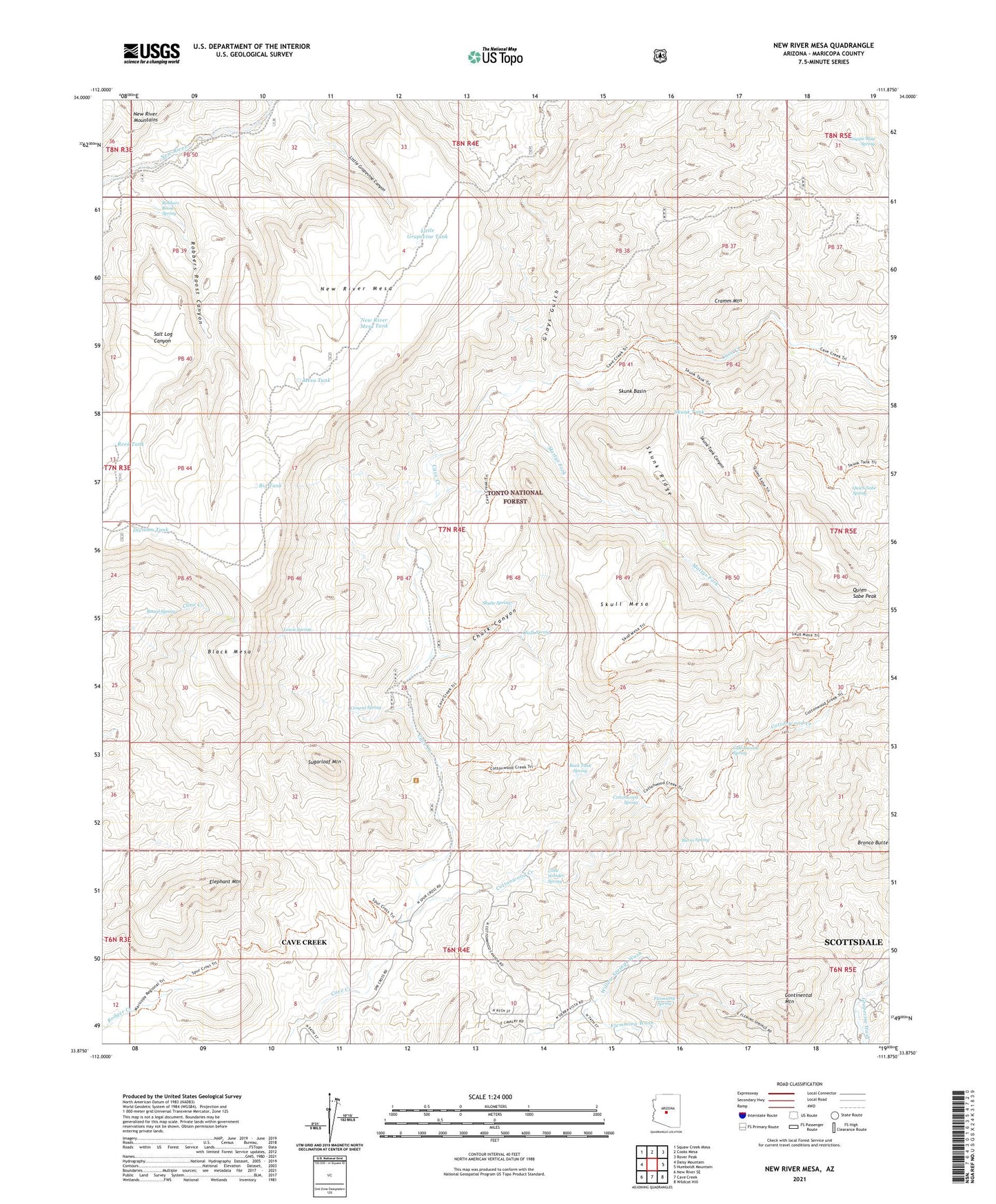
New River Mesa Arizona US Topo Map
Couldn't load pickup availability
Also explore the New River Mesa Forest Service Topo of this same quad for updated USFS data
2021 topographic map quadrangle New River Mesa in the state of Arizona. Scale: 1:24000. Based on the newly updated USGS 7.5' US Topo map series, this map is in the following counties: Maricopa. The map contains contour data, water features, and other items you are used to seeing on USGS maps, but also has updated roads and other features. This is the next generation of topographic maps. Printed on high-quality waterproof paper with UV fade-resistant inks.
Quads adjacent to this one:
West: Daisy Mountain
Northwest: Squaw Creek Mesa
North: Cooks Mesa
Northeast: Rover Peak
East: Humboldt Mountain
Southeast: Wildcat Hill
South: Cave Creek
Southwest: New River SE
This map covers the same area as the classic USGS quad with code o33111h8.
Contains the following named places: Ashdale Administrative Site, Big Maggie May, Big Tank, Black Mesa, Board Spring, Burro Spring, Cement Spring, Chalk Canyon, Chalk Spring, Continental Mountain, Cottonwood Creek, Cottonwood Spring, Cramm Mountain, Division Tank, Elephant Mountain, Flemming Spring, Flemming Wash, Grays Gulch, Grays Gulch Mine, Lewis Spring, Liscum, Little Grapevine Canyon, Little Grapevine Tank, Little Wonder Spring, Lopez Tank, Maggie May Spring, Maricopa Mine, Mattys Fork, Mesa Tank, Middle Tank, New River Mesa, New River Mesa Tank, Phoenix Mine, Quien Sabe Creek, Quien Sabe Mine, Quien Sabe Peak, Quien Sabe Spring, Reed Tank, Road Tank, Robbers Roost Canyon, Robbers Roost Spring, Rock Tank Spring, Ruin Tank, Shulte Spring, Skull Mesa, Skunk Basin, Skunk Ridge, Skunk Tank, Skunk Tank Canyon, Spur Cross Ranch Conservation Area, Sugarloaf Mountain, ZIP Code: 85331