MyTopo
Willcox North Arizona US Topo Map
Couldn't load pickup availability
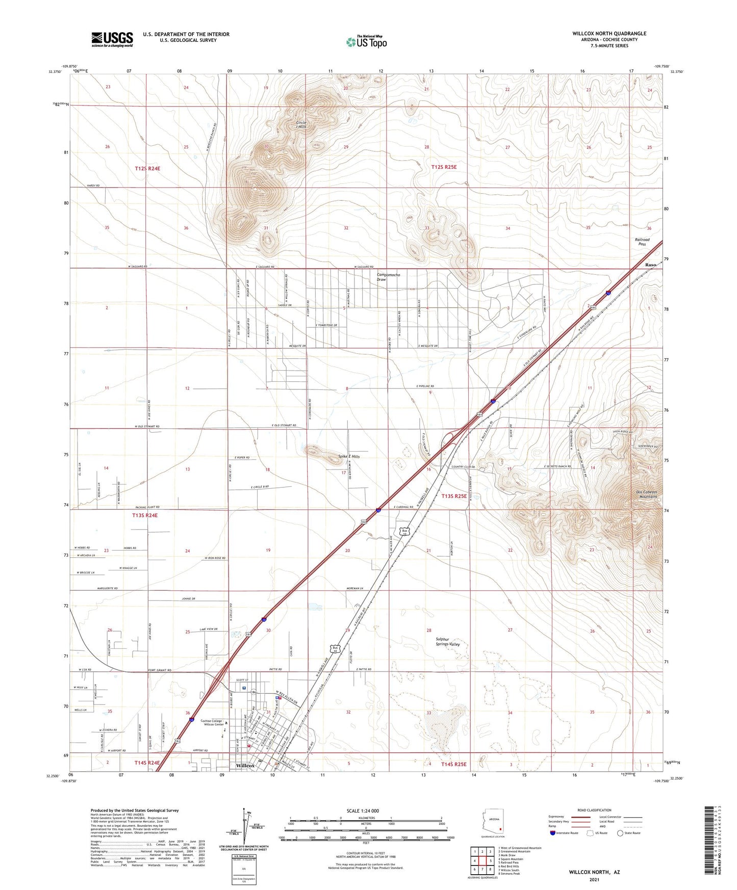
2021 topographic map quadrangle Willcox North in the state of Arizona. Scale: 1:24000. Based on the newly updated USGS 7.5' US Topo map series, this map is in the following counties: Cochise. The map contains contour data, water features, and other items you are used to seeing on USGS maps, but also has updated roads and other features. This is the next generation of topographic maps. Printed on high-quality waterproof paper with UV fade-resistant inks.
Quads adjacent to this one:
West: Square Mountain
Northwest: West of Greasewood Mountain
North: Greasewood Mountain
Northeast: Monk Draw
East: Railroad Pass
Southeast: Simmons Peak
South: Willcox South
Southwest: Red Bird Hills
This map covers the same area as the classic USGS quad with code o32109c7.
Contains the following named places: Campomocho Draw, Church of Christ, Circle I Hills, City of Willcox, Cochise College - Willcox Center, Cochise Visitor Center, Dry Lake, Dry Lakes, Elsie S Hogan Community Library, Faith Bible Church, First Assembly of God, First Baptist Church, First Southern Baptist Church, Grace Chapel, Historic Railroad Avenue Park, Jesse Street Minipark, Keiller Park and Recreation Center, KHIL-AM (Willcox), Kingdom Hall of Jehovahs Witnesses, KWCX-FM (Willcox), Manny Gonzales Park, Northern Cochise Community Hospital, Northern Cochise Community Hospital Heliport, Ppep Tec High School Eugene Lopez Learning Center, Raso, Red Tail Substation, Sheriffs Posse Arena, Spike E Hills, Trinity Lutheran Church, Victory Baptist Church, Willcox, Willcox City Hall, Willcox Community Center Park, Willcox Elementary School, Willcox Fire Department Station 1, Willcox Fire Department Station 2, Willcox High School, Willcox Middle School, Willcox Police Department, Willcox Post Office, Willcox United Methodist Church