MyTopo
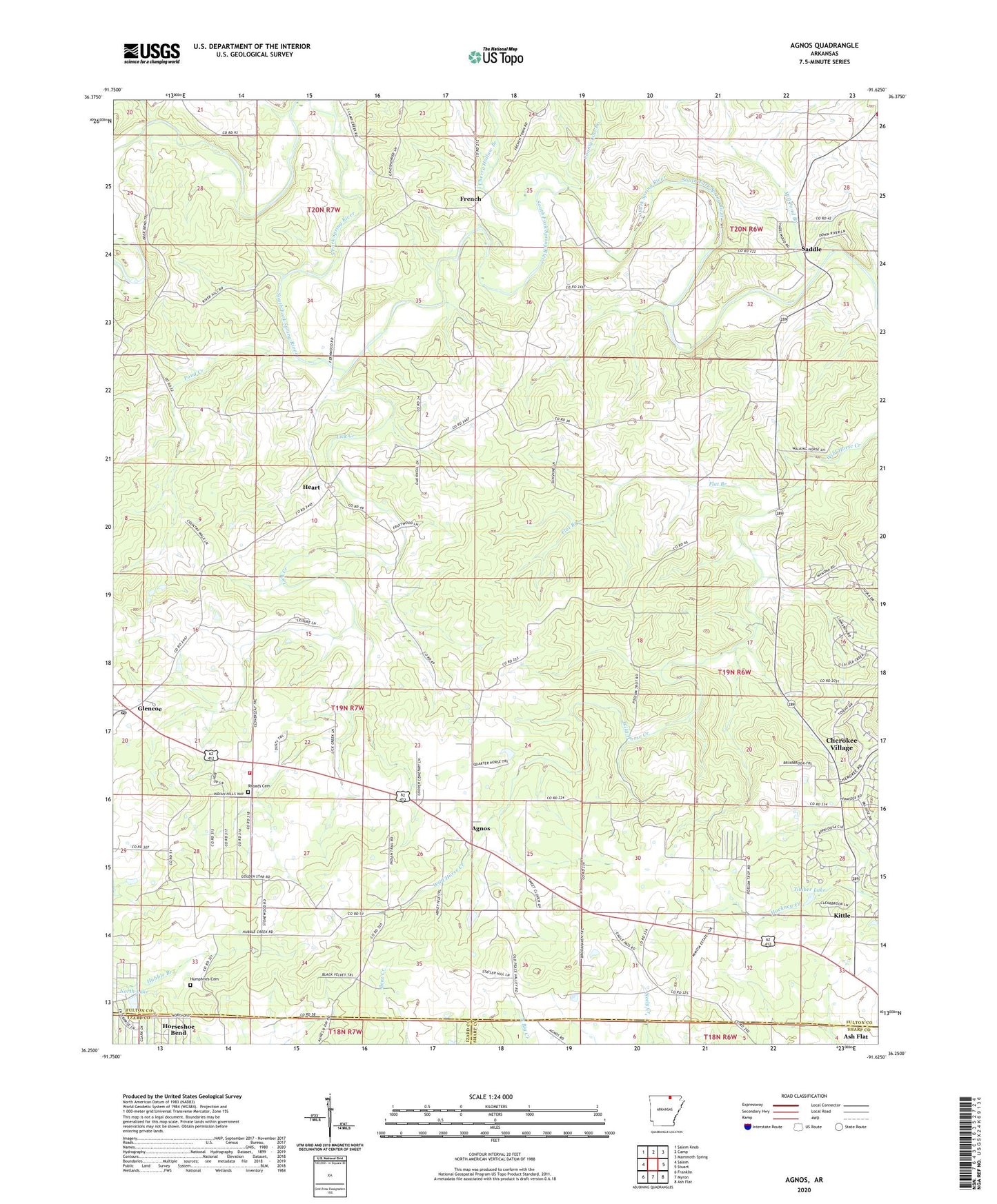
Agnos Arkansas US Topo Map
Couldn't load pickup availability
2024 topographic map quadrangle Agnos in the state of Arkansas. Scale: 1:24000. Based on the newly updated USGS 7.5' US Topo map series, this map is in the following counties: Fulton, Izard, Sharp. The map contains contour data, water features, and other items you are used to seeing on USGS maps, but also has updated roads and other features. This is the next generation of topographic maps. Printed on high-quality waterproof paper with UV fade-resistant inks.
Quads adjacent to this one:
West: Salem
Northwest: Salem Knob
North: Camp
Northeast: Mammoth Spring
East: Stuart
Southeast: Ash Flat
South: Myron
Southwest: Franklin
This map covers the same area as the classic USGS quad with code o36091c6.
Contains the following named places: Agnos, Agnos - Heart - Glencoe Volunteer Fire Department, Burks Chapel, Cherokee Sanitary Landfill, Cherry Hollow Branch, County Line Branch, Flat Branch, French, Glencoe, Glencoe Post Office, Heart, Heart Church, Humphries Cemetery, KHAM-AM (Horseshoe Bend), Kittle, Lake Brown, Lake Brown Dam, Lick Creek, Mill Pond Branch, Nazarene Church, North Lake, North Lake Dam, Pond Creek, Rhoads Cemetery, Saddle, Saddle Baptist Church, Timber Lake, Timber Lake Dam, Township of Pleasant Ridge, ZIP Code: 72539