MyTopo
Salem Arkansas US Topo Map
Couldn't load pickup availability
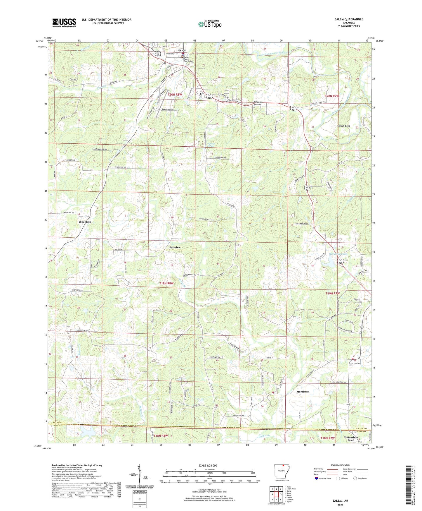
2024 topographic map quadrangle Salem in the state of Arkansas. Scale: 1:24000. Based on the newly updated USGS 7.5' US Topo map series, this map is in the following counties: Fulton, Izard. The map contains contour data, water features, and other items you are used to seeing on USGS maps, but also has updated roads and other features. This is the next generation of topographic maps. Printed on high-quality waterproof paper with UV fade-resistant inks.
Quads adjacent to this one:
West: Byron
Northwest: Viola
North: Salem Knob
Northeast: Camp
East: Agnos
Southeast: Myron
South: Franklin
Southwest: Oxford
This map covers the same area as the classic USGS quad with code o36091c7.
Contains the following named places: City of Salem, Dogget Lake, Dogget Lake Dam, Fairview, Flint Hill School, Fulton County Sheriff's Office, Horton Branch, Hubble Branch, Liberty Hill Church, McCullough Lake, McCullough Lake Dam, Morriston, Morriston Fire Department Old Field Station 2, Morriston Fire Department Station 1, Pinhook Bend, Raney Branch, Salem, Salem Airport, Salem Elementary School, Salem High School, Salem Police Department, Salem Post Office, Salem Volunteer Fire Department, Township of Strawberry, Wheeler Hollow, Wheeler Spring, Wheeling, ZIP Code: 72576