MyTopo
Morrilton West Arkansas US Topo Map
Couldn't load pickup availability
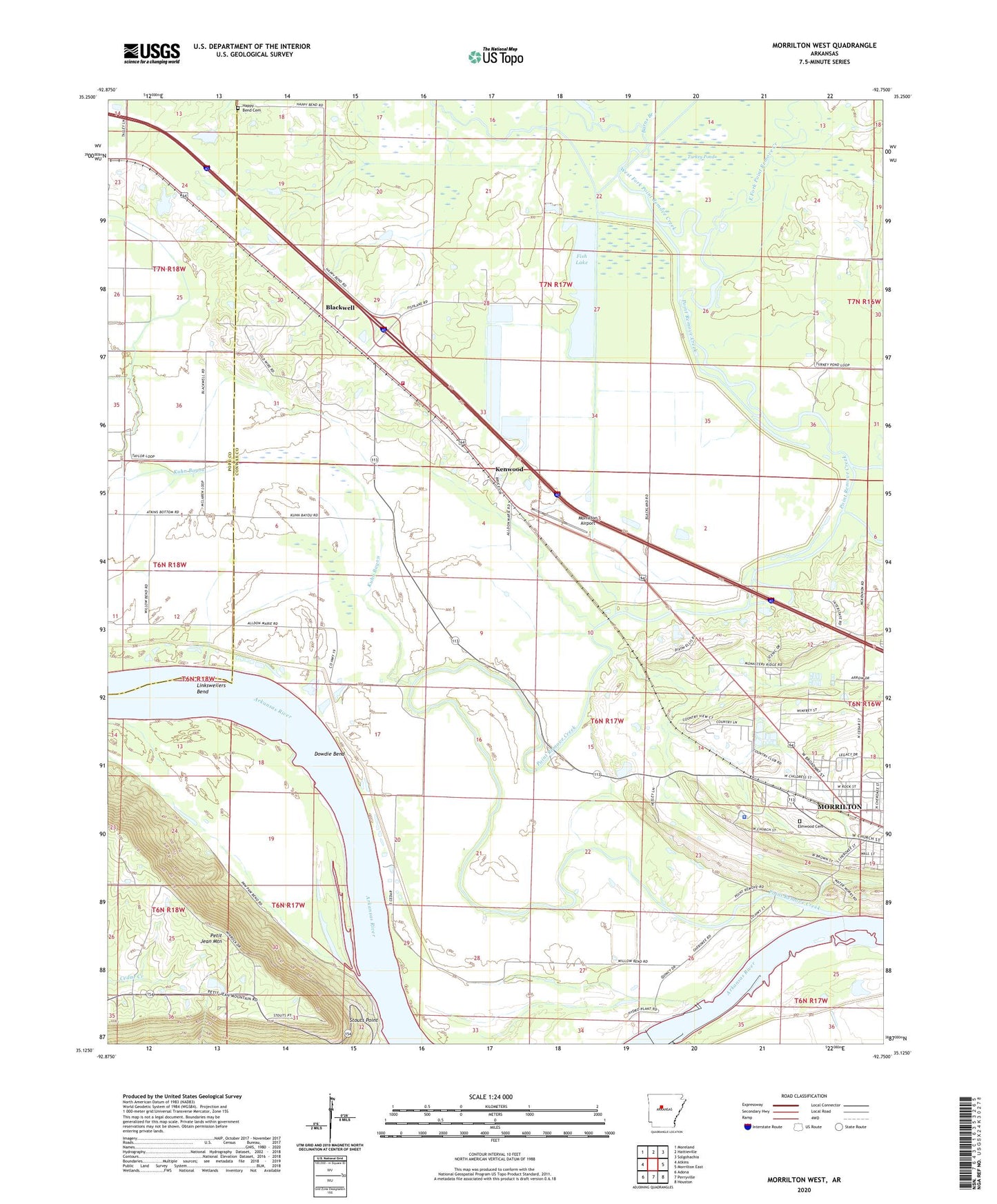
2024 topographic map quadrangle Morrilton West in the state of Arkansas. Scale: 1:24000. Based on the newly updated USGS 7.5' US Topo map series, this map is in the following counties: Conway, Pope. The map contains contour data, water features, and other items you are used to seeing on USGS maps, but also has updated roads and other features. This is the next generation of topographic maps. Printed on high-quality waterproof paper with UV fade-resistant inks.
Quads adjacent to this one:
West: Atkins
Northwest: Moreland
North: Hattieville
Northeast: Solgohachia
East: Morrilton East
Southeast: Houston
South: Perryville
Southwest: Adona
This map covers the same area as the classic USGS quad with code o35092b7.
Contains the following named places: Barns Branch, Blackwell, Blackwell - Kenwood Volunteer Fire Department, Camp Mitchell, Conway County Sheriff's Office, Country Estates, Dam Site 9 Public Use Area, Dowdie Bend, East Fork Point Remove Creek, Elmwood Cemetery, First Assembly of God Church, Fish Lake, Fish Lake Dam, Garden of Gethsemane United Church of God in Christ, Happy Bend Cemetery, Index, Kenwood, Kuhn Bayou, KVOM-AM (Morrilton), KVOM-FM (Morrilton), Linksweilers Bend, Lock and Dam Number Nine, Morrilton Airport, Point Remove Canal, Point Remove Creek, Point Remove Creek Old Channel, Point Remove Public Use Area, Pool Nine, Saint Matthew Church, Spring Meadows, Stouts Point, Township of Welborn, Turkey Pond, West Fork Point Remove Creek, West Side Kindergarten, West Side Kindergarten School, ZIP Code: 72110