
MyTopo
Hattieville Arkansas US Topo Map
Couldn't load pickup availability
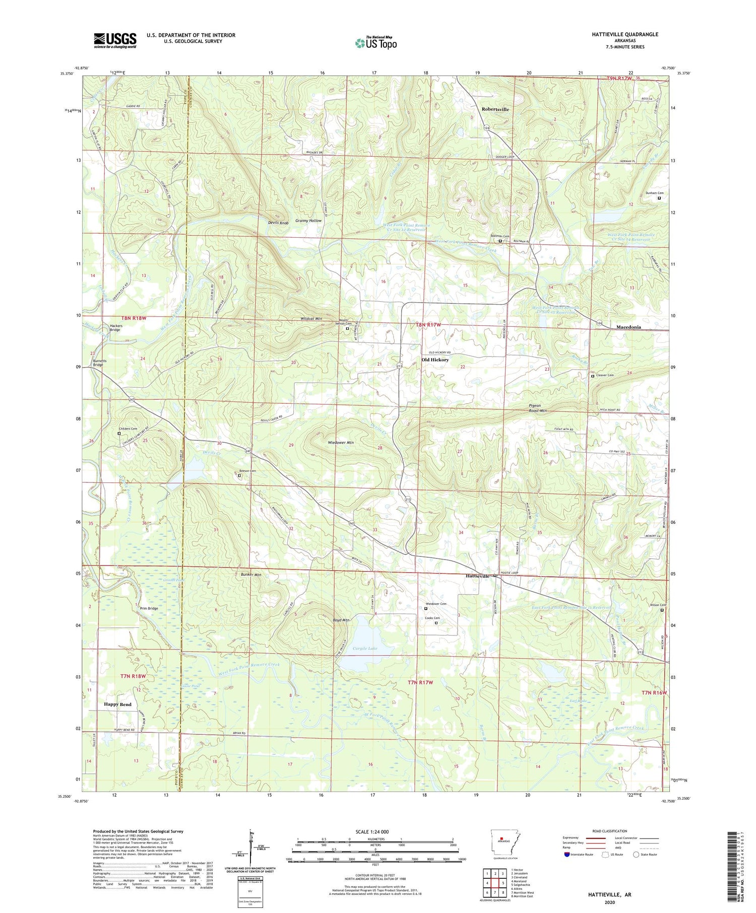
2024 topographic map quadrangle Hattieville in the state of Arkansas. Scale: 1:24000. Based on the newly updated USGS 7.5' US Topo map series, this map is in the following counties: Conway, Pope. The map contains contour data, water features, and other items you are used to seeing on USGS maps, but also has updated roads and other features. This is the next generation of topographic maps. Printed on high-quality waterproof paper with UV fade-resistant inks.
Quads adjacent to this one:
West: Moreland
Northwest: Hector
North: Jerusalem
Northeast: Cleveland
East: Solgohachia
Southeast: Morrilton East
South: Morrilton West
Southwest: Atkins
This map covers the same area as the classic USGS quad with code o35092c7.
Contains the following named places: Beeson Cemetery, Boltman Cemetery, Boyd Mountain, Bunker Mountain, Burnetts Bridge, Canady Branch, Cargile Lake, Cargile Lake Dam, Cedar Branch, Childers Cemetery, Cleaver Cemetery, Cooks Cemetery, Devils Creek, Devils Knob, Dunham Cemetery, Earl Brake, East Fork Point Remove Site 11 Dam, East Fork Point Remove Site 11 Reservoir, Goose Pond, Granny Hollow, Grinnel Pond, Gum Log Creek, Hackers Bridge, Hackers Creek, Happy Bend, Hattieville, Hattieville Census Designated Place, Hattieville Post Office, Isabell Creek, Macedonia, Mount Vernon Cemetery, Mount Zion School, New Mount Zion Church, Nichols Church, Old Hickory, Old Hickory Gas Field, Pigeon Roost Mountain, Plainview Church, Pool Hollow Branch, Prim Bridge, Robertsville, Rocky Branch, Taw Branch, Township of Gregory, Township of Old Hickory, West Fork Point Remove Creek Site 12 Dam, West Fork Point Remove Creek Site 12 Reservoir, West Fork Point Remove Creek Site 13 Dam, West Fork Point Remove Creek Site 13 Reservoir, West Fork Point Remove Creek Site 14 Dam, West Fork Point Remove Creek Site 14 Reservoir, West Fork Point Remove Creek Site 15 Dam, West Fork Point Remove Creek Site 15 Reservoir, West Fork Point Remove Creek Site 16 Dam, West Fork Point Remove Creek Site 16 Reservoir, Wiedower Cemetery, Wiedower Mountain, Wildcat Mountain, Wilson Cemetery, Zion Hill Church, ZIP Code: 72063


