MyTopo
Newell Arkansas US Topo Map
Couldn't load pickup availability
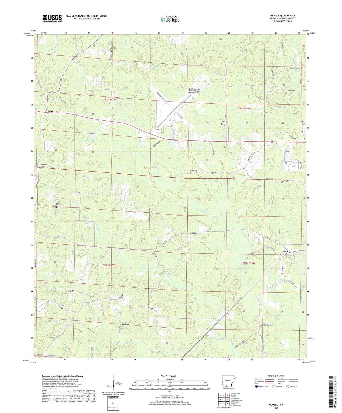
2024 topographic map quadrangle Newell in the state of Arkansas. Scale: 1:24000. Based on the newly updated USGS 7.5' US Topo map series, this map is in the following counties: Union. The map contains contour data, water features, and other items you are used to seeing on USGS maps, but also has updated roads and other features. This is the next generation of topographic maps. Printed on high-quality waterproof paper with UV fade-resistant inks.
Quads adjacent to this one:
West: Marysville
Northwest: Mount Holly
North: Lisbon
Northeast: Smackover
East: El Dorado West
Southeast: Junction City
South: Wesson
Southwest: Wesson SW
This map covers the same area as the classic USGS quad with code o33092b7.
Contains the following named places: Burns Pond, Cairo, Cairo Oil and Gas Field, Cairo Rural Fire Department, Carroll Cemetery, Curtis Creek, Curtis Grove Cemetery, East Shuler Oil and Gas Field, Fast Ambulance Service, Friendship Cemetery, Friendship Methodist Church, Goodwin Cemetery, Goodwin Field Church, Griffin, Harris Cemetery, Hopewell Baptist Church, Hopewell Cemetery, Jay Dison Spring Branch, Landmark Church, Lisbon Oil and Gas Field, Mount Renia Cemetery, Mount Willie Cemetery, Mount Willie Church, Mount Zion Cemetery, Mount Zion Church, Pate Cemetery, Shuler Oil and Gas Field, South Arkansas Regional Airport at Goodwin Field, Township of Wesson, Trull