MyTopo
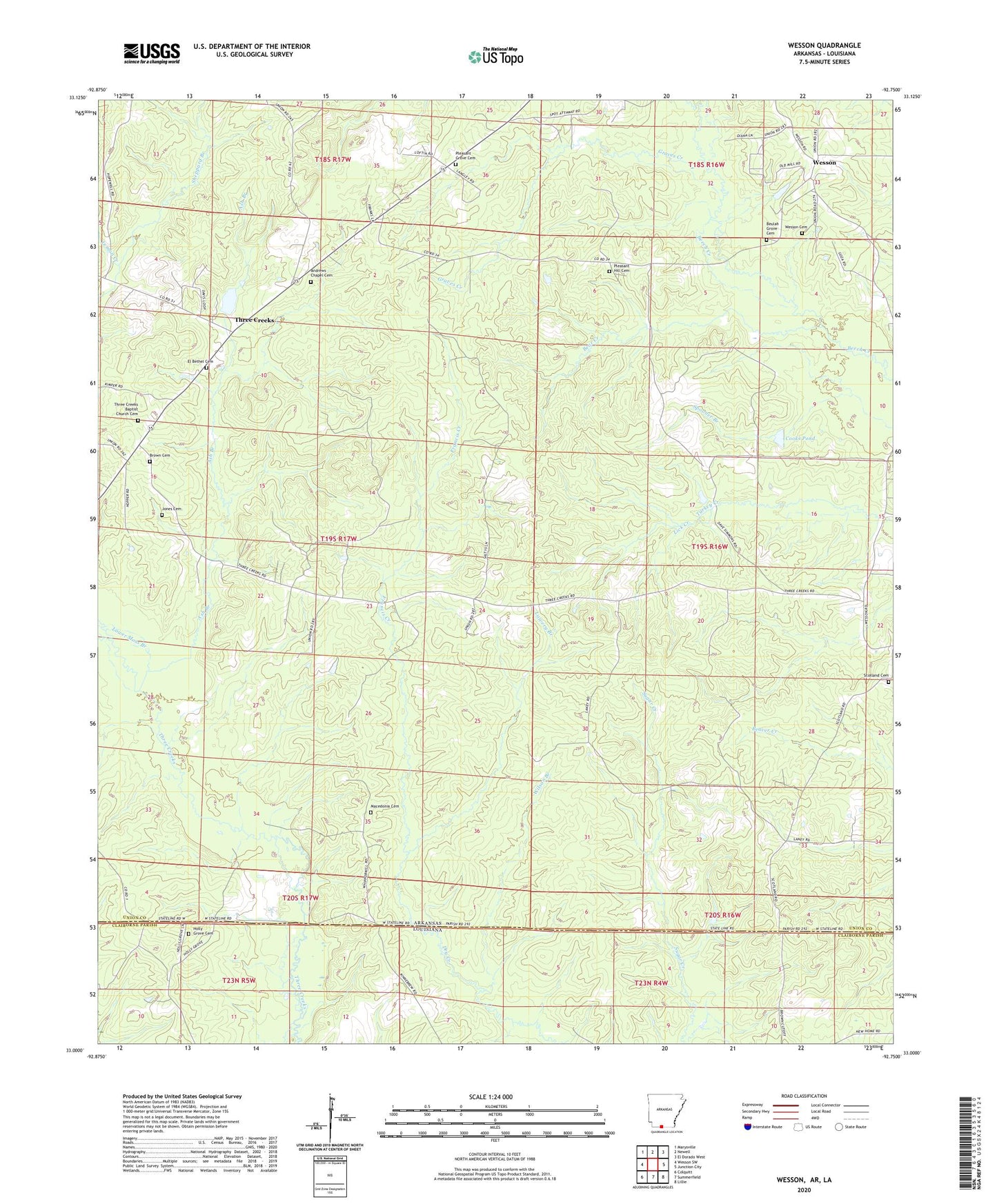
Wesson Arkansas US Topo Map
Couldn't load pickup availability
2024 topographic map quadrangle Wesson in the states of Arkansas, Louisiana. Scale: 1:24000. Based on the newly updated USGS 7.5' US Topo map series, this map is in the following counties: Union, Claiborne. The map contains contour data, water features, and other items you are used to seeing on USGS maps, but also has updated roads and other features. This is the next generation of topographic maps. Printed on high-quality waterproof paper with UV fade-resistant inks.
Quads adjacent to this one:
West: Wesson SW
Northwest: Marysville
North: Newell
Northeast: El Dorado West
East: Junction City
Southeast: Lillie
South: Summerfield
Southwest: Colquitt
Contains the following named places: Andrews Chapel Cemetery, Arkansas Noname 49 Dam, Ash Branch, Bear Creek, Beulah Grove Cemetery, Brown Cemetery, Cooks Pond, El Bethel Cemetery, El Bethel Church, Francis Creek, Graves Creek, Hayes Branch, Holly Grove Cemetery, Holly Grove Church, Jones Cemetery, Lower Moss Branch, Lowery Branch, Macedonia Cemetery, Macedonia Church, Mount Pigeon Church, Pleasant Grove Cemetery, Pleasant Grove Methodist Church, Pleasant Hill Cemetery, Pleasant Hill Church, Scotland Cemetery, Sheppard Branch, Three Creeks, Three Creeks Baptist Church, Three Creeks Baptist Church Cemetery, Township of Cornie, Township of Henderson, Wesson, Wesson Baptist Church, Wesson Cemetery, Wesson Post Office, Wilson Branch, ZIP Code: 71749