MyTopo
Round Hill Arkansas US Topo Map
Couldn't load pickup availability
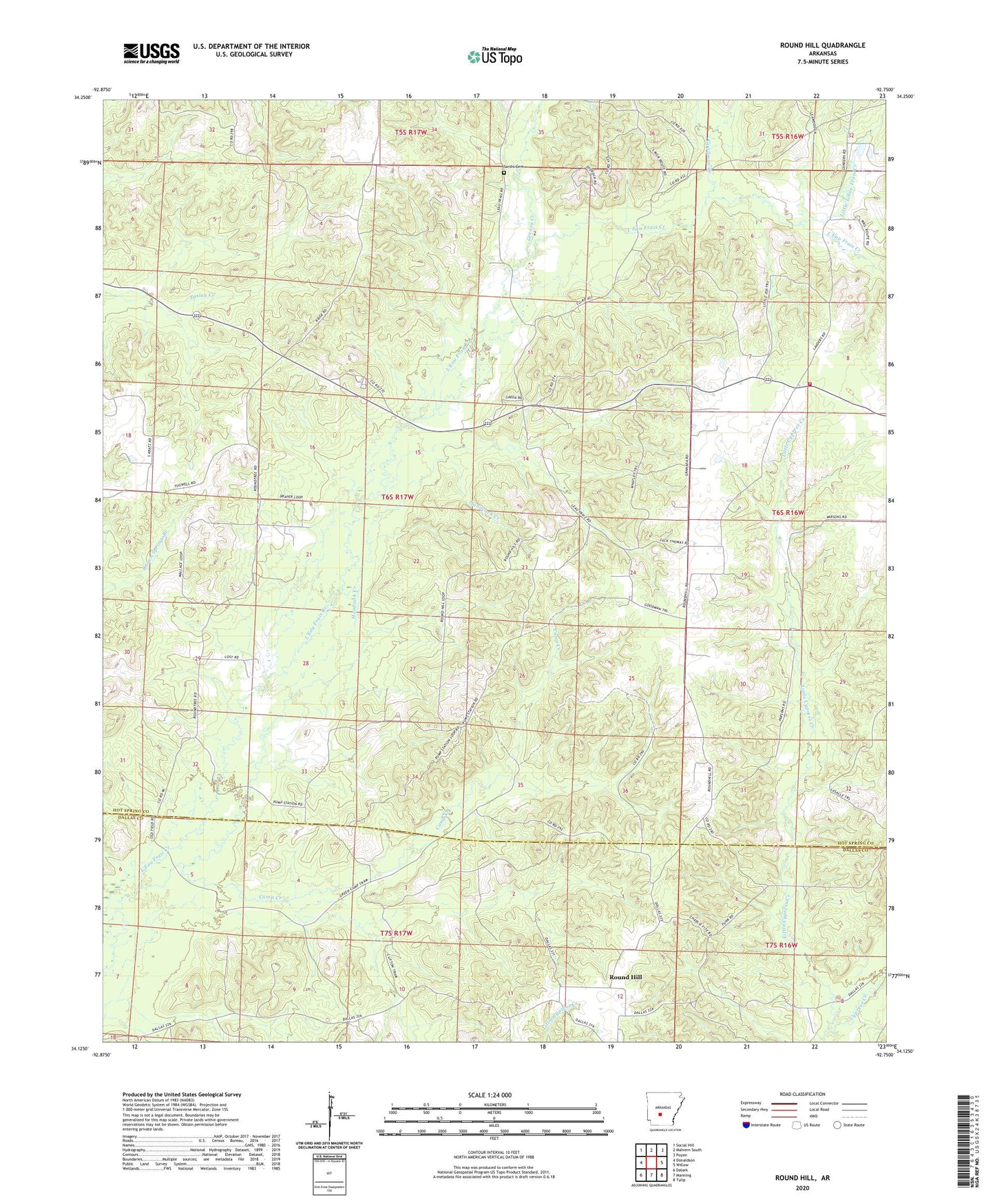
2024 topographic map quadrangle Round Hill in the state of Arkansas. Scale: 1:24000. Based on the newly updated USGS 7.5' US Topo map series, this map is in the following counties: Hot Spring, Dallas. The map contains contour data, water features, and other items you are used to seeing on USGS maps, but also has updated roads and other features. This is the next generation of topographic maps. Printed on high-quality waterproof paper with UV fade-resistant inks.
Quads adjacent to this one:
West: Donaldson
Northwest: Social Hill
North: Malvern South
Northeast: Poyen
East: Willow
Southeast: Tulip
South: Manning
Southwest: Dalark
This map covers the same area as the classic USGS quad with code o34092b7.
Contains the following named places: Camp Creek, Goodman Branch, Greasy Creek, Handcock Creek, L'Eau Frais Church, Little Cypress Creek, Little L'Eau Frais Creek, Lono Rolla Volunteer Fire Department Station 1, Pleasant Grove Church, Pleasant Hill Church of Christ, Round Hill, Round Hill Church, Sardis Cemetery, Sardis Church, Township of Harrison