MyTopo
Donaldson Arkansas US Topo Map
Couldn't load pickup availability
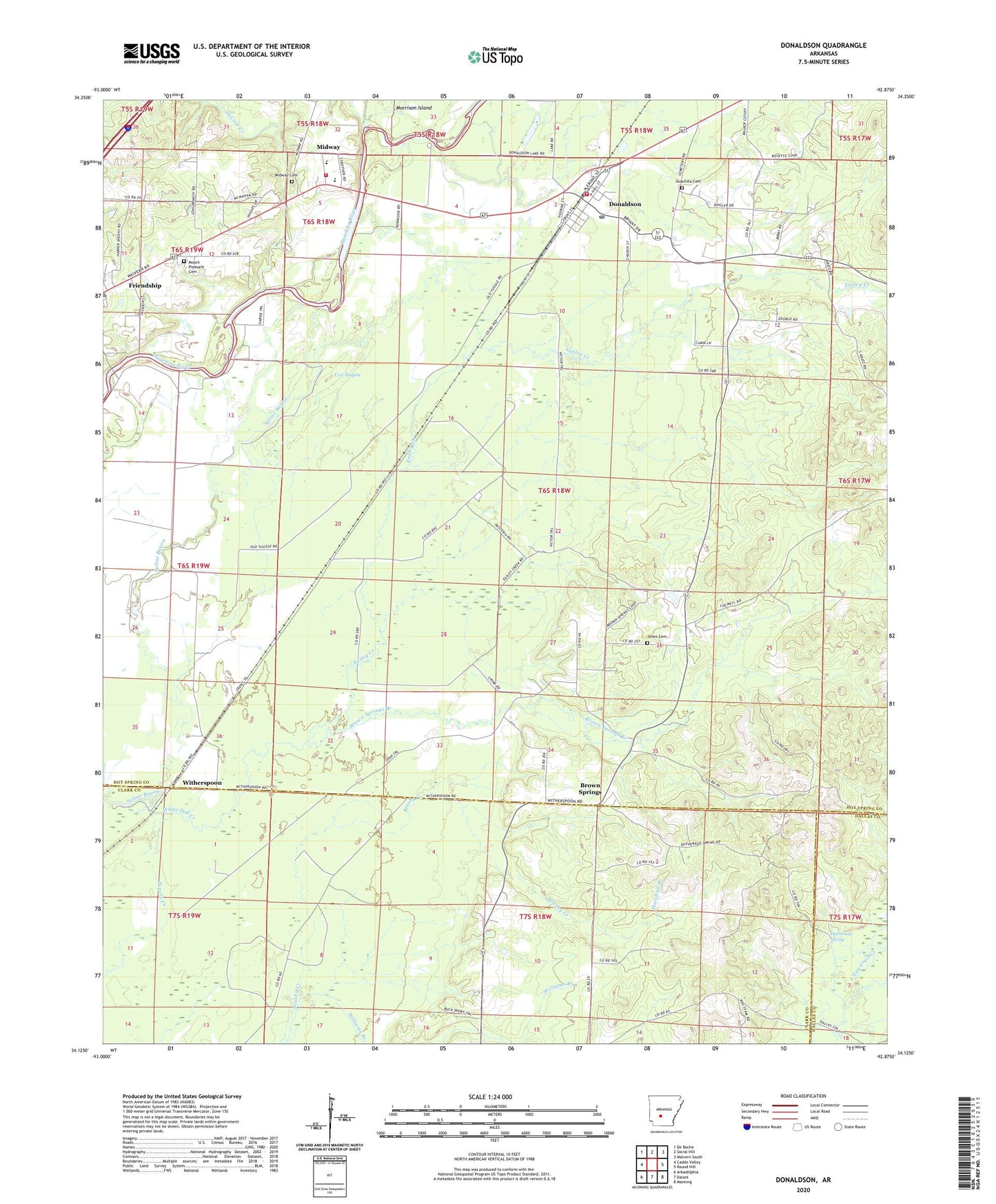
2024 topographic map quadrangle Donaldson in the state of Arkansas. Scale: 1:24000. Based on the newly updated USGS 7.5' US Topo map series, this map is in the following counties: Hot Spring, Clark, Dallas. The map contains contour data, water features, and other items you are used to seeing on USGS maps, but also has updated roads and other features. This is the next generation of topographic maps. Printed on high-quality waterproof paper with UV fade-resistant inks.
Quads adjacent to this one:
West: Caddo Valley
Northwest: De Roche
North: Social Hill
Northeast: Malvern South
East: Round Hill
Southeast: Manning
South: Dalark
Southwest: Arkadelphia
This map covers the same area as the classic USGS quad with code o34092b8.
Contains the following named places: Anchor Baptist Church, Brown Springs, Brown Springs Branch, Cox Bayou, DeLisle Creek, Donaldson, Donaldson City Marshal, Donaldson Post Office, Donaldson School, Dutherage Spring, Easley Creek, Faber, Friendship Post Office, Jones Cemetery, Marshall Branch, Midway Cemetery, Mount Moriah Baptist Church, Mount Pleasant Cemetery, Ouachita Cemetery, Ouachita Church, Ouachita Elementary School, Ouachita Fire Department, Ouachita Fire Department Donaldson Station, Ouachita High School, Riverside Baptist Church, Town of Donaldson, Township of Brown Springs, Township of Ouachita, West Fork DeLisle Creek, White Oak Creek, Williams Branch, Witherspoon, ZIP Code: 71941