MyTopo
Alcalde Hills California US Topo Map
Couldn't load pickup availability
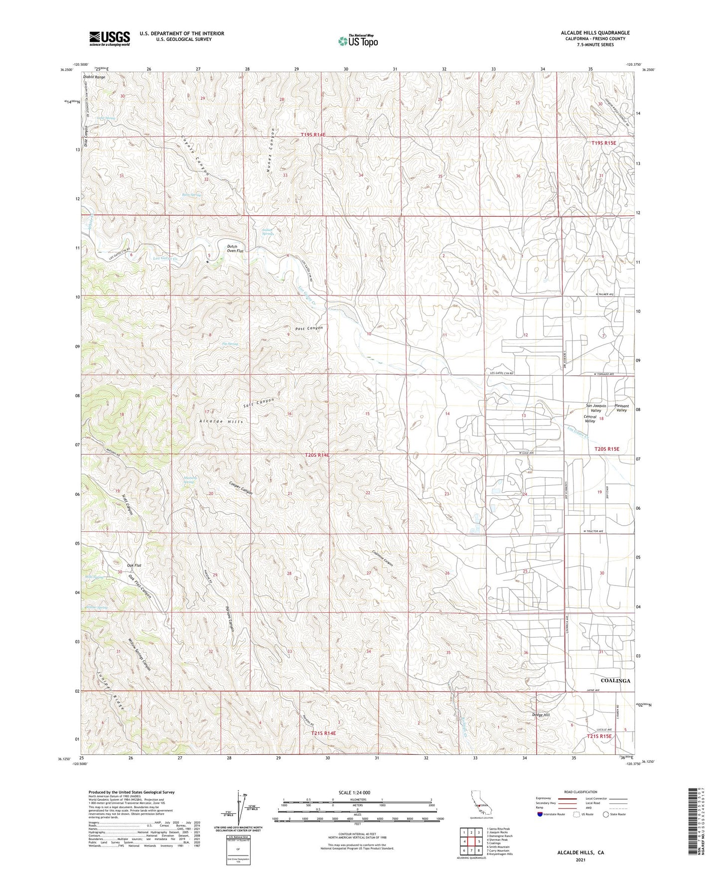
2021 topographic map quadrangle Alcalde Hills in the state of California. Scale: 1:24000. Based on the newly updated USGS 7.5' US Topo map series, this map is in the following counties: Fresno. The map contains contour data, water features, and other items you are used to seeing on USGS maps, but also has updated roads and other features. This is the next generation of topographic maps. Printed on high-quality waterproof paper with UV fade-resistant inks.
Quads adjacent to this one:
West: Sherman Peak
Northwest: Santa Rita Peak
North: Joaquin Rocks
Northeast: Domengine Ranch
East: Coalinga
Southeast: Kreyenhagen Hills
South: Curry Mountain
Southwest: Smith Mountain
This map covers the same area as the classic USGS quad with code o36120b4.
Contains the following named places: Alcalde Hills, Barn Spring, Camp 25-D, Camp 7-C, Claremont School, Coalinga Division, Coalmine Canyon, Coyote Canyon, Dodge Hill, Dutch Oven Flat, Fig Spring, Indian Springs, Lane Spring, Mills Spring, Mustang Spring, Nunez Canyon, Oak Flat, Parsons Canyon, Post Canyon, Salt Canyon, Scott Canyon, Sprague Cabin, White Creek, Willow Spring, ZIP Code: 93210