
MyTopo
Avenal Gap California US Topo Map
Couldn't load pickup availability
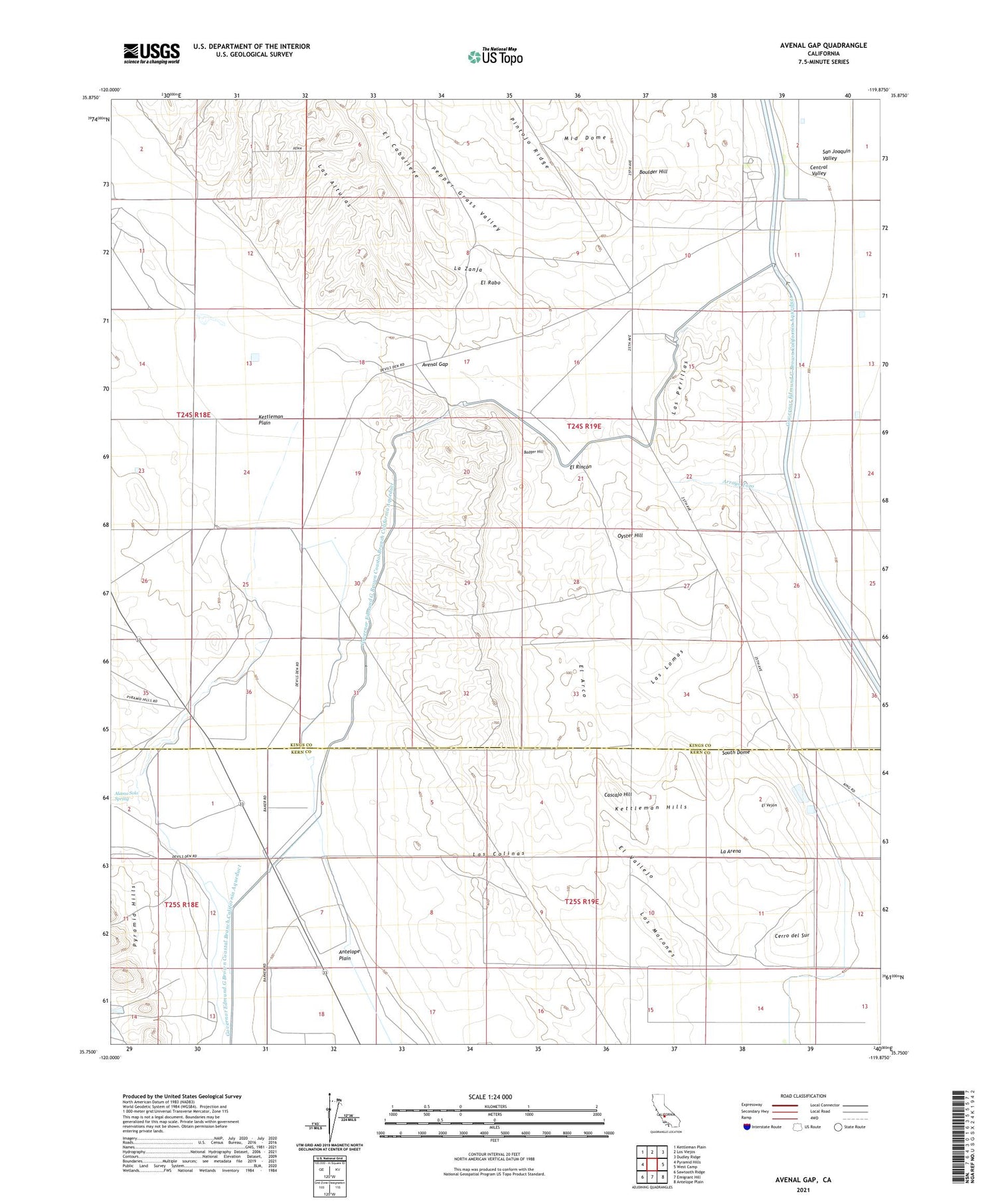
2021 topographic map quadrangle Avenal Gap in the state of California. Scale: 1:24000. Based on the newly updated USGS 7.5' US Topo map series, this map is in the following counties: Kings, Kern. The map contains contour data, water features, and other items you are used to seeing on USGS maps, but also has updated roads and other features. This is the next generation of topographic maps. Printed on high-quality waterproof paper with UV fade-resistant inks.
Quads adjacent to this one:
West: Pyramid Hills
Northwest: Kettleman Plain
North: Los Viejos
Northeast: Dudley Ridge
East: West Camp
Southeast: Antelope Plain
South: Emigrant Hill
Southwest: Sawtooth Ridge
This map covers the same area as the classic USGS quad with code o35119g8.
Contains the following named places: Alamo Solo Spring, Arroyo Ancho, Arroyo Petreo, Arroyo Tozo, Avenal Gap, Badger Hill, Boulder Hill, Cascajo Hill, Cerro del Sur, Devils Den, Devils Den Post Office, Devils Den School, El Arco, El Rabo, El Rincon, El Vallejo, El Vejon, Governor Edmund G Brown Coastal Branch California Aqueduct, La Arena, La Zanja, Las Colinas, Las Lomas, Las Perillas, Las Perillas Pumping Plant, Los Morones, Oyster Hill, Pepper Grass Valley, Pintojo Ridge, South Dome


